 Park of China
Rivers and Lakes of China See also: Yellow River
The longest river in China, about 6,300 km, known in its upper reaches as the Tuotuo, Tongtian and Jinsha rivers. Its basin covers roughly 1.8 million sq km and includes the Three Gorges, Dongting Lake and Poyang Lake. Rises in Geladandong peak, Tanggula Mountains, Qinghai-Tibet Plateau. Flows into the East China Sea. Flows through Qinghai, Tibet, Sichuan, Yunnan, Chongqing, Hubei, Hunan, Jiangxi, Anhui, Jiangsu, Shanghai.


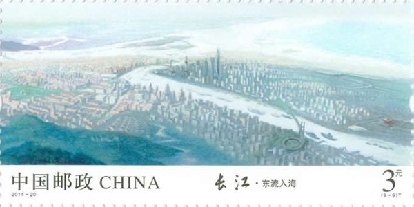
In 2014 China Post issued 2014-20 “The Yangtze River”, nine stamps: the great river flowing east, the hills and waters of Chongqing, the wonders of the Three Gorges, the river in Hubei and Hunan, the waters of Mount Lu, Huangshan, spring in Nanjing, water towns by the river and flowing east into the sea.


Parks and sites (9)
Yunnan
- Three Parallel Rivers of Yunnan: High mountains and gorges; wildlife
- Jade Dragon Snow Mountain and Lijiang: Snow mountain, old town, gorge, lake, matriarchal Mosuo culture
Chongqing
- The Three Gorges of the Yangtze: Deep V-shaped gorges
- Lesser Three Gorges
Hunan
- Dongting Lake: Lake; one of the famous towers of the south
Anhui
Jiangsu
Cities along the river: Panzhihua, Yibin, Luzhou, Chongqing, Yichang, Jingzhou, Yueyang, Wuhan, Ezhou, Huangshi, Jiujiang, Anqing, Chizhou, Tongling, Wuhu, Maanshan, Nanjing, Zhenjiang, Yangzhou, Taizhou, Nantong, Shanghai.