 Park of China
Overview
| Name | Huanjiang Karst 环江喀斯特 |
| Web address | https://parkofchina.com/en/huanjiangkarst.html |
| Designation | UNESCO World Heritage (natural, 2014): part of “South China Karst” National nature reserve (1998, “Mulun National Nature Reserve”) AAAA tourist attraction (“Mulun Karst Eco-tourism Scenic Area”) |
| Province | Guangxi |
| Location | North-west of Huanjiang Maonan Autonomous County, Hechi, Guangxi, within the Mulun National Nature Reserve; borders Libo, Guizhou, to the north |
| Latitude, longitude | 25.17, 107.99 Google Maps |
| Highlights | Cone karst (fengcong), karst forest |
| Top sights | Fengcong peaks and depressions, karst forest |
| Nearby cities | Guiyang |
| Nearby sites | Libo and the Zhangjiang River 28km, Pingtang Scenic Area 99km, Liping Dong Villages 160km |
| Themes | Karst, Forest, Plant |
About
Huanjiang Karst is in the north-west of Huanjiang Maonan Autonomous County, Guangxi. In 2014 it was inscribed as a World Natural Heritage Site in the second phase of the “South China Karst”. The property lies within the Mulun National Nature Reserve and borders Libo in Guizhou to the north; it is regarded as a natural extension of the Libo Karst.
This is cone karst: conical limestone peaks rise in clusters joined at their bases, known as fengcong, with enclosed depressions between them. The peaks are covered in almost pristine monsoon forest, a subtropical mixed evergreen and deciduous broadleaf forest on limestone. The Mulun reserve is also a UNESCO Man and the Biosphere Reserve.
Travel tips
Getting there: the reserve is some 40 km north-west of Huanjiang town, reached by road from the town; Libo in Guizhou lies to the north.
Visiting: the reserve is mainly for conservation; the Mulun Karst Eco-tourism Scenic Area inside it is a national AAAA tourist attraction.
Season: spring and autumn are best; summer is rainy.
Stamps
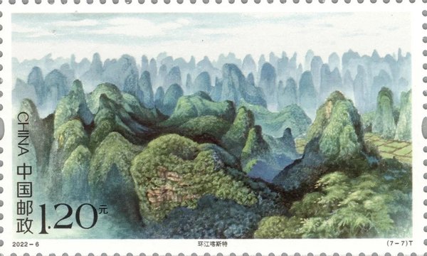
The seventh stamp of the 2022 set 2022-6 “World Natural Heritage – South China Karst” shows the Huanjiang karst. The full set is on the South China Karst page.
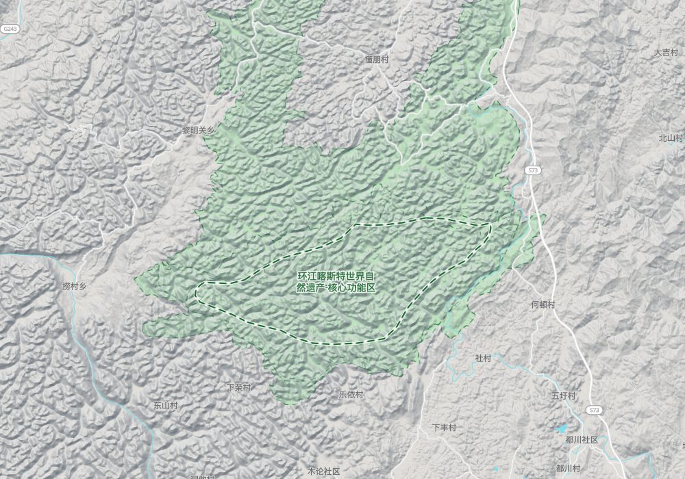
Map
Nearby
| World Heritage | Libo and the Zhangjiang River 28km, Wuyang River 210km, Li River 253km, Jiangzhou District rock art 294km |
| National parks | Rongjiang: Miao Mountains and Dong Waters 96km, Pingtang Scenic Area 99km, Mount Doupeng and the Jian River, Duyun 148km, Liping Dong Villages 160km |
| AAAAA attractions | Qingyan Ancient Town Scenic Area 184km, Chengyang Eight Villages Scenic Area 185km, Baise Uprising Memorial Park Scenic Area 196km |
| AAAA attractions | Niujiaozhai Waterfalls 42km, Zhenzhu Rock 46km |
| UNESCO Global Geoparks | Leye-Fengshan UNESCO Global Geopark 129km |
| Historical sites | Fengtengshan Ancient Tombs 27km |
| National geoparks | Luocheng National Geopark 87km, Dahua Qibainong National Geopark 116km, Fengshan Karst National Geopark 125km, Du'an Underground River National Geopark 137km |
| Nature reserves | Maolan National Nature Reserve 26km, Jiuwanshan National Nature Reserve 63km, Yuanbaoshan National Nature Reserve 123km, Leigongshan National Nature Reserve 137km |