 Park of China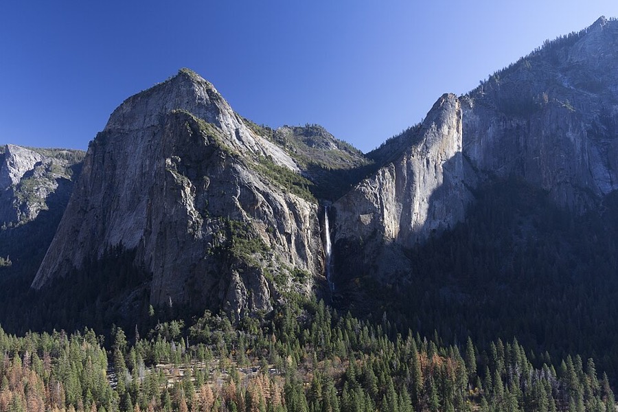
Overview
| Designation | UNESCO World Heritage (natural, 1984) US National Park |
| Latitude, longitude | 37.7, -119.6 Google Maps |
| Nearby cities | San Francisco |
| Highlights | U-shaped valley, a rock-climbing mecca, high waterfalls, giant sequoias |
| Top sights | Glacier Point, Half Dome |
| Wildlife | Black bears, deer, giant sequoias |
| Nearby sites | Sequoia and Kings Canyon National Parks, Pinnacles National Park, Redwood National Park, Death Valley National Park, Lassen Volcanic National Park |
| Themes | Mountain, Valley, Glacial, Waterfall, Peak, Cliff, Wildlife, Stream, Forest, Stamp, Banknote, Hiking & climbing, Viewpoints & photography, Ancient trees |
About

Yosemite National Park is in the United States. It became a US national park in 1890, and in 1984 it was added to the UNESCO World Heritage List as a natural site.
Visitor map

Main sights
Yosemite Valley: a glacial valley along the Merced River, about 12 km long, walled by almost vertical granite cliffs; most sights and lodging are here.
El Capitan: a single block of granite on the north side of the valley rising about 900 metres from the floor, among the best-known climbing walls in the world.
Half Dome: a granite peak at the east end of the valley with one nearly sheer face, about 2,693 metres above sea level and the park's emblematic shape.
Yosemite Falls: about 739 metres in three sections (upper fall, cascades and lower fall), one of the highest waterfalls in North America and strongest in spring.
Bridalveil Fall: near the entrance on the south side of the valley, about 188 metres high, with the water often blown into mist.
Tunnel View: at the exit of the tunnel on CA-41 into the valley, with El Capitan, Bridalveil Fall and Half Dome in one view.
Glacier Point: a viewpoint on the cliff top south of the valley, about 975 metres above the floor, facing Half Dome and, higher up, Nevada and Vernal Falls.
Mariposa Grove: at the south end of the park, with over 500 mature giant sequoias, among them the Grizzly Giant, more than 2,000 years old.
Tuolumne Meadows: a high meadow at about 2,600 metres in the east of the park, ringed by granite domes and peaks and the start of many high-country trails.
Hetch Hetchy: in the north-west, a glacial valley like Yosemite Valley but now flooded by a reservoir that is one of the water sources for San Francisco.
Geology and landscape
The rock of Yosemite is mainly granite, formed by magma cooling deep underground about 100 million years ago and part of the Sierra Nevada batholith.
As the range rose, the rock above was eroded and the granite was exposed. Granite with few joints resists erosion, which is why El Capitan and Half Dome survive as single huge masses.
Over the past two to three million years glaciers moved down the Merced River valley several times, widening and deepening a V-shaped river valley into a U-shape with steep walls and a flat floor.
Glaciers in side valleys were smaller than the main one and left the side valleys hanging above it; streams fall over the edges as waterfalls, as Yosemite Falls and Bridalveil Fall do.
The last large glaciers left the valley more than 10,000 years ago. Only small ice bodies remain in the park today; lakes left on the valley floor were later filled with sediment to become meadows.
History and culture
Native people lived in Yosemite Valley more than a thousand years ago; the Ahwahneechee called the valley Ahwahnee.
In 1851 a militia unit entered the valley, the first outsiders to describe it. Painters and photographers then carried images of it to the East.
In 1864 President Lincoln signed an act granting the valley and Mariposa Grove to California for protection, an early precedent for protecting scenery for the public.
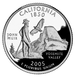
The national park was established in 1890, with naturalist John Muir among its advocates; the photographer Ansel Adams later became famous for his black-and-white images of the park.
It was inscribed as a World Heritage Site in 1984 for its granite cliffs, glacial features and waterfalls.
Travel tips
Getting there: the nearest large airport is Fresno, about 1.5 hours from the park, and Merced has a railway station. From San Francisco the drive is about 4 hours. Without a car, take Amtrak to Merced and then a YARTS bus into the valley.
Entrances: The main ones are South (CA-41, for Mariposa Grove), Arch Rock (CA-140) and Big Oak Flat (CA-120). Tioga Pass on CA-120 in the east is closed in winter and usually opens between late May and June.
In the valley: Yosemite Valley has a free shuttle loop, and the sights are close together. Glacier Point Road is closed in winter; in summer you can drive to Glacier Point for the view of Half Dome.
Main sights: The valley has Yosemite Falls, El Capitan and Bridalveil Fall; the Mist Trail leads to Nevada Fall; permits to climb Half Dome are drawn by lottery.
Season: Waterfalls are strongest in May and June; Tioga Pass and Tuolumne Meadows open in July and August; in autumn the falls are often dry; in winter the valley has snow scenes and skiing is near Glacier Point.
Time: Two days for the valley and Glacier Point; three or four days to add Mariposa Grove and the high country.
Where to stay: In the valley there are the Majestic Yosemite Hotel (formerly the Ahwahnee), Yosemite Valley Lodge and campgrounds, which should be booked months ahead in season; outside the park, Oakhurst, Mariposa and Groveland have hotels.
More photos


Map

Photo credits: Half Dome: Tuxyso (CC BY-SA 3.0, Wikimedia Commons); Yosemite Valley: King of Hearts (CC BY-SA 3.0, Wikimedia Commons)