 Park of China
Overview
| Designation | US National Park |
| Location | Northern California, USA |
| Latitude, longitude | 40.5, -121.4 Google Maps |
| Nearby cities | San Francisco |
| Area | 106,400 acres |
| Elevation | 10,457 feet |
| Nearby sites | Redwood National Park 248km, Crater Lake National Park 273km Search nearby |
| Themes | Volcano, Mountain, Geothermal, Lake, Hiking & climbing, Scenic drives |
About
Lassen Volcanic National Park is in northern California. It became a US national park in 1916.
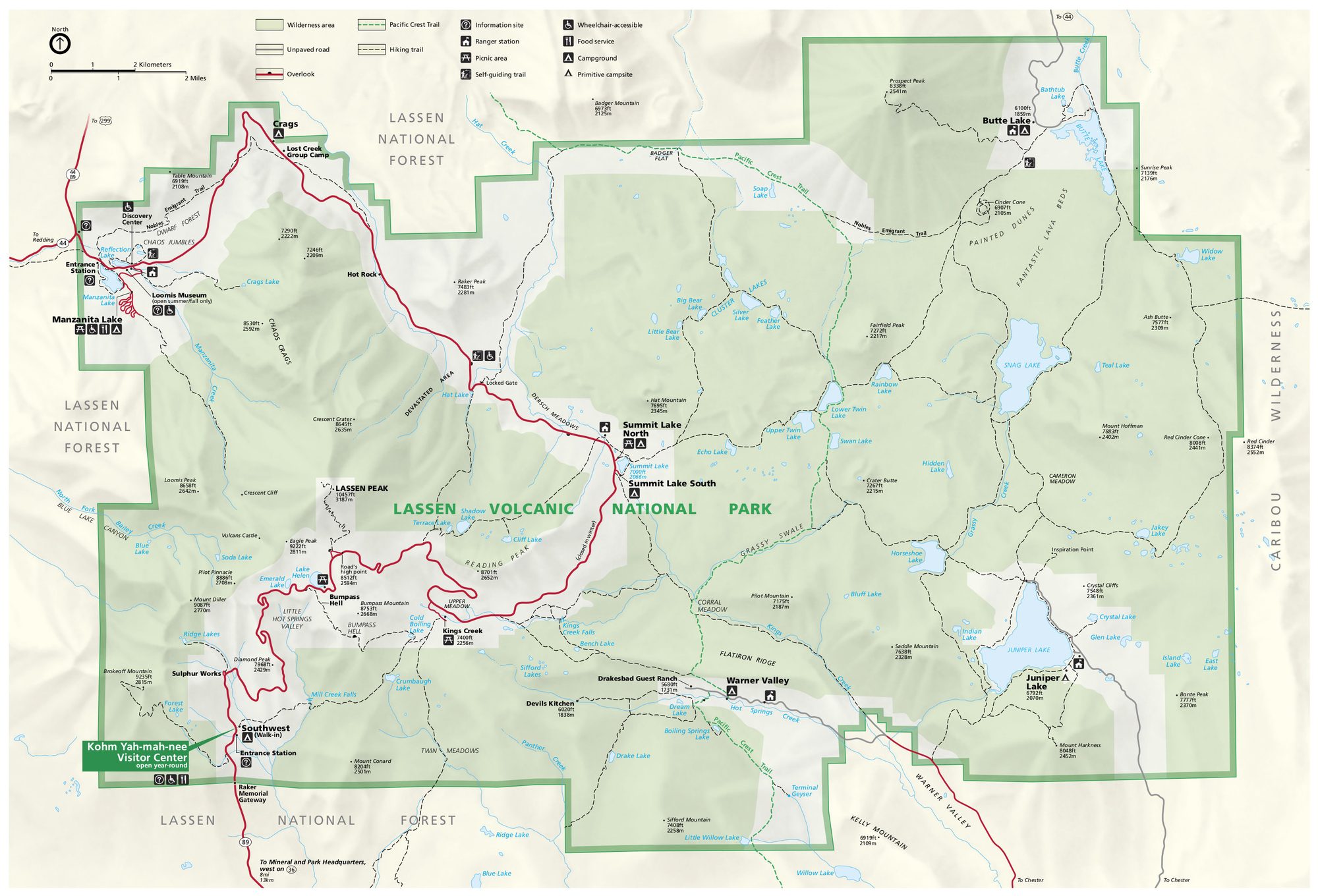
Visitor map
Travel tips
Getting there: the park is in northern California. The nearest airport is Redding, about 80 km to the west, and Sacramento is about 280 km to the south. San Francisco is about 4.5 hours by car.
The road: the main road is Lassen Park Road, part of California Highway 89, about 48 km long. The high section is closed by snow in winter and usually opens fully only in June.
Lassen Peak: a trail climbs the peak (3,187 m), about 8 km round trip with about 650 m of ascent. The surface is loose and steep, taking 4 to 5 hours. Snow often lingers and the route is safer from July.
Thermal area: Bumpass Hell is the largest geothermal area in the park, with steaming mud pots and fumaroles. The walk is about 5 km round trip on boardwalks, which you should not leave.
Lakes: Manzanita Lake near the north-west entrance suits an easy walk, and Summit Lake lies midway along the road.
Volcanic remains: Lassen Peak erupted in 1915 and left the Devastated Area on its north side, with a short interpretive trail.
Season: summer to early autumn is easiest, and from July to September the high trails are usually free of snow. Spring has heavy snow and winter allows only skiing and snowshoeing.
Where to stay: the park has several campgrounds and cabins at Manzanita Lake, which need booking in summer; outside the park, lodging is mainly in Redding and Red Bluff.
Map
