Park of China
Overview
| Designation | US National Park |
| Location | Southeastern California, USA |
| Latitude, longitude | 36.1, -116.9 Google Maps |
| Highlights | Desert, extreme heat |
| Top sights | Devil's Golf Course |
| Wildlife | Bighorn sheep, rattlesnakes |
| Area | 3,400,000 acres |
| Elevation | -86 m |
| Nearby cities | Las Vegas |
| Nearby sites | Great Basin National Park, Sequoia and Kings Canyon National Parks, Yosemite National Park, Grand Canyon National Park, Joshua Tree National Park |
| Themes | Desert, Valley, Mountain, Peak, Glen, Sand Dune, Volcano, Mystery, Night sky & aurora, Scenic drives, Hiking & climbing, Viewpoints & photography |
About
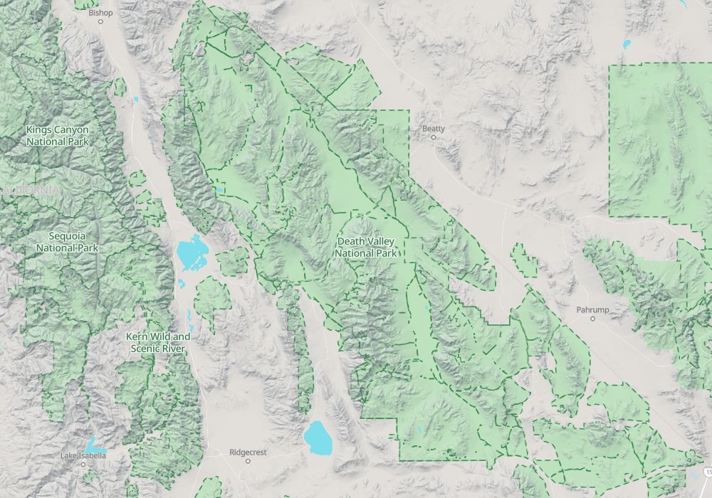
Death Valley National Park is in southeastern California, with a small part in Nevada. It is a desert landscape and became a US national park in 1994.
Its lowest point is 282 ft (86 m) below sea level, the lowest point in the Western Hemisphere.
Death Valley holds the Western Hemisphere's record high temperature: 134°F (56.7°C).
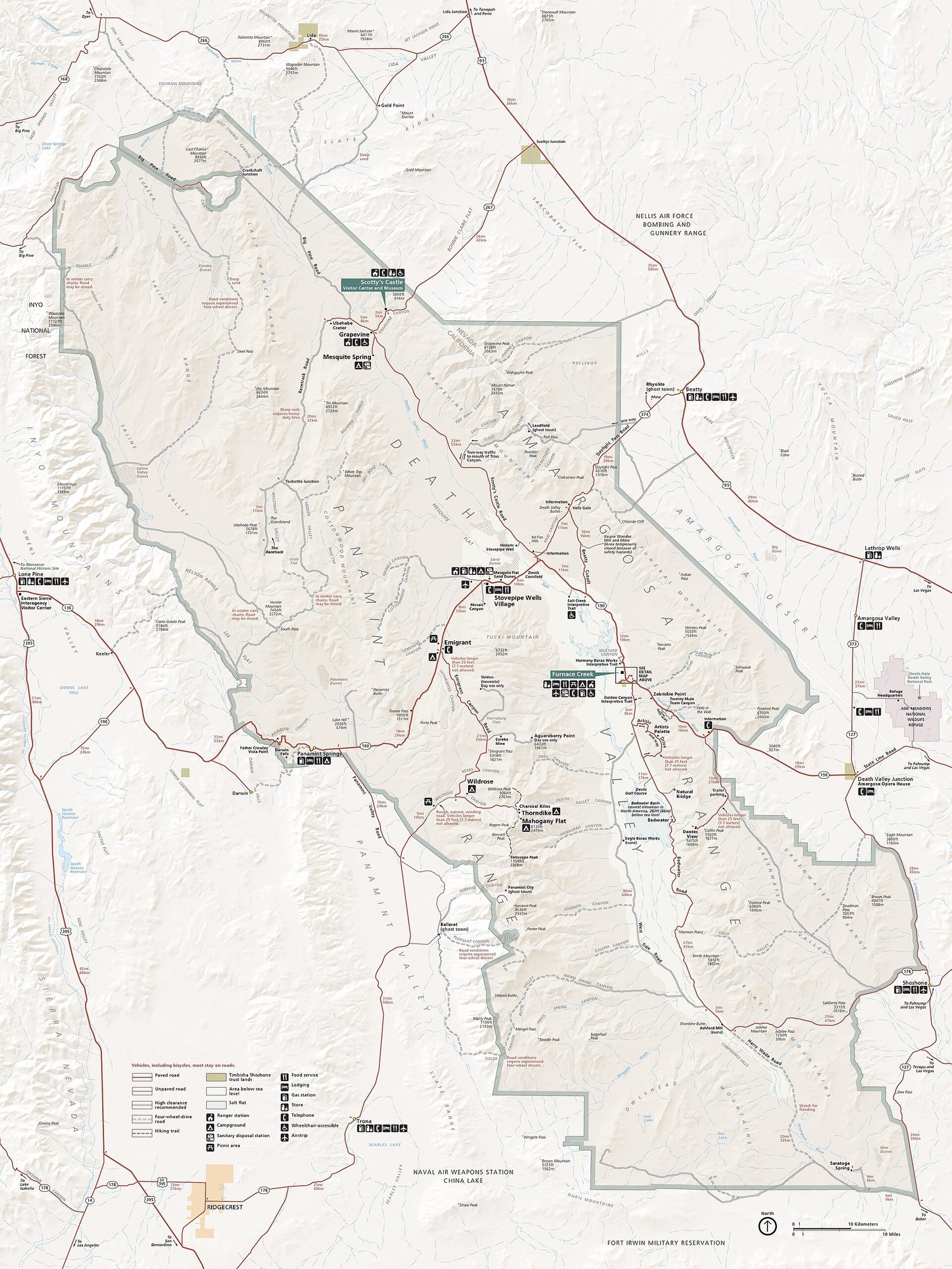
Visitor map
Travel tips
Getting there: the nearest big city is Las Vegas, two to two and a half hours' drive to the east side of the park; Los Angeles is about four and a half to five hours. The park is huge, so a car is essential.
Park centre: Furnace Creek has the visitor centre, fuel, a shop and lodging; other settlements are Stovepipe Wells and Panamint Springs.
Main sights: Badwater Basin lies 86 metres below sea level; Artists Drive crosses coloured hillsides; the Devil's Golf Course is a surface of salt crystals; Zabriskie Point is a favourite place for sunrise.
High points: Dante's View at about 1,670 metres looks over the whole basin; in summer the mountains are more than 10 degrees Celsius cooler than the floor.
Dunes: the Mesquite Flat Sand Dunes are near Stovepipe Wells and are best at sunrise and sunset, not in the heat of the day.
Time: one day covers the central sights; farther places such as the Racetrack Playa need another day or two and rough dirt roads.
Season: November to March is best; summer afternoons often exceed 45 degrees Celsius and are not suitable for walking; wildflowers sometimes appear in spring.
Where to stay: Furnace Creek and Stovepipe Wells have lodging and campgrounds in limited numbers, needing early booking in winter and spring; towns outside the park such as Pahrump are an alternative.
Caution: fill the tank before entering, carry plenty of water, and expect almost no phone signal; summer heat can be fatal, so do not go far from your vehicle.
Safety
Death Valley is the lowest, hottest and driest place in the United States. Summer heat puts visitors at risk of dehydration, and some visitors have died here.
Fill up your tank and bring plenty of drinking water before you enter. If you plan to visit remote areas, carry extra spare tires.
Death Valley also has venomous animals such as rattlesnakes, scorpions and black widow spiders.
Half-day tour
Start from the Furnace Creek Visitor Center and drive to Badwater Basin, 86 m below sea level.
Return the same way and stop at Devil's Golf Course on the way.
Take Artist's Drive to Artist's Palette.
Back at Furnace Creek, turn right onto Highway 190 to visit Twenty Mule Team Canyon and Zabriskie Point.
One-day tour
Add these to the half-day tour:
Drive up to Dante's View, at 1,700 m, for a view over Death Valley.
See the dunes at Mesquite Flat Sand Dunes.
Longer stays
Visit Mosaic Canyon.
Visit Scotty's Castle.
Death Valley has clean air, clear skies and no light pollution, so it is good for stargazing at night.
The moving rocks
The rocks on Racetrack Playa move by themselves and leave tracks on the dry lakebed. They are one of Death Valley's strangest sights.
The most popular explanation is that strong winds push the rocks.
Getting there
Death Valley is about 2.5 hours from Las Vegas. Route from Las Vegas:
US 95 north -> SR 373 south -> SR 190 west
Map