 Park of China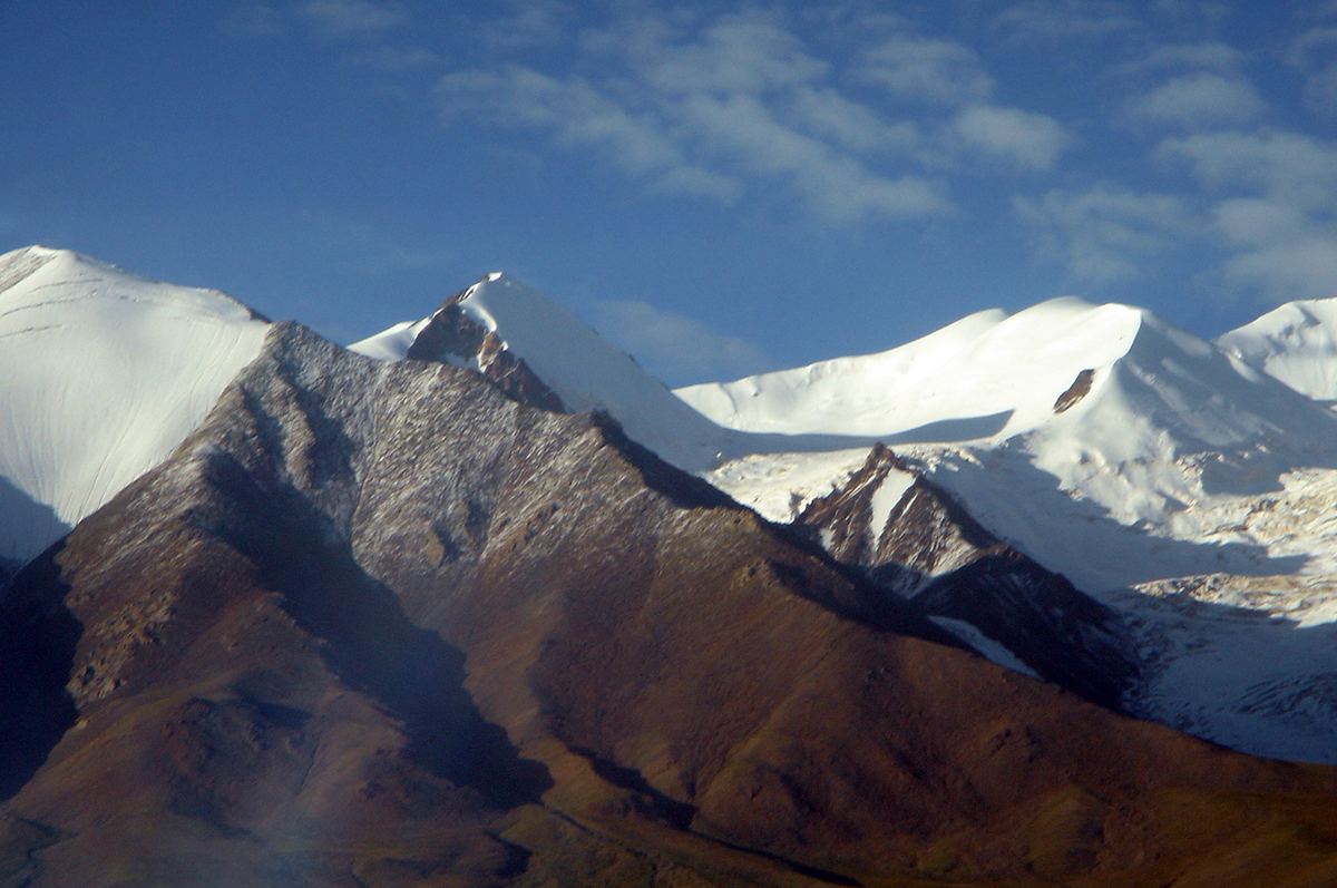
Overview
| Designation | National Park of China (seventh batch) |
| Province | Tibet |
| Location | Tibet |
| Mountains / Rivers and lakes | Tanggula Mountains; Nu River |
| Latitude, longitude | 32.0, 91.6 Google Maps |
| Nearby sites | Namtso and the Nyainqêntanglha Mountains 173km, The Potala Palace, Lhasa 264km, Yarlung River 302km, Yamdrok Lake 348km, Qinghai Hoh Xil 384km Search nearby |
| Nearby cities | Lhasa, Gyantse |
| Themes | Mountain, Highland, Glacier, Long River |
About
The Tanggula Mountains on the border of Tibet and Qinghai, crossed by the Qinghai–Tibet railway at over 5,000 m, and the headwaters of the Nu (Salween) River on their southern slopes form a national park of high plateau, glaciers and grassland.
It is in the seventh batch of national parks of China (national scenic areas) named by the State Council in 2009.
Travel tips
Getting there: The Tanggula range lies between Tibet and Qinghai, and both the Qinghai-Tibet highway and railway cross it. From Lhasa the road goes north through Damxung and Nagqu and is long, so most visitors use a 4WD vehicle or charter a car; road and weather vary widely. Entry to Tibet requires permits arranged in advance, and foreign visitors need an additional travel permit.
Tanggula Pass: The pass is above 5,000 m and is one of the highest points on the Qinghai-Tibet highway. There is a roadside marker where you can stop for photos, and the railway passes nearby.
Source of the Nu River: The Nu River rises on the south side of the range around Amdo County. The terrain is cold, high and remote, and a driver or guide who knows the area is needed.
Time: From Lhasa allow at least three to four days return, staying in Nagqu or Amdo on the way.
Season: The best months are roughly June to September. Winter is severe, with heavy snow, and the pass is often closed.
Where to stay: Nagqu and Amdo have simple hotels. There is no lodging near the pass.
Altitude: The altitude is higher than Lhasa or Namtso, and the lack of oxygen is more noticeable. Acclimatise in Lhasa for several days, carry oxygen, and do not linger at the pass.
Caution: Tibetan antelope and wild yak can be seen along the road; do not chase or feed them. Ultraviolet light is strong, so bring sunglasses and sun protection.
Photo credits: Snow peaks of the Tanggula Mountains, Tibetan Plateau: Taken by Fanghong (CC BY 2.5, Wikimedia Commons)
Nearby
| World Heritage | The Potala Palace, Lhasa 264km, Qinghai Hoh Xil 384km, Khangchendzonga National Park 564km, Manas Wildlife Sanctuary 589km |
| National parks of China | Sanjiangyuan National Park 484km |
| National parks | Namtso and the Nyainqêntanglha Mountains 173km, Yarlung River 302km |
| AAAAA attractions | Jokhang Temple 265km, Basum Lake Scenic Area 315km |
| AAAA attractions | Sapu Tourist Scenic Area 58km |
| Cities | Lhasa 266km |
| National geoparks | Yangbajing National Geopark 235km |
| Nature reserves | Siling Co National Nature Reserve 246km, Lhalu Wetland National Nature Reserve 263km |