 Park of China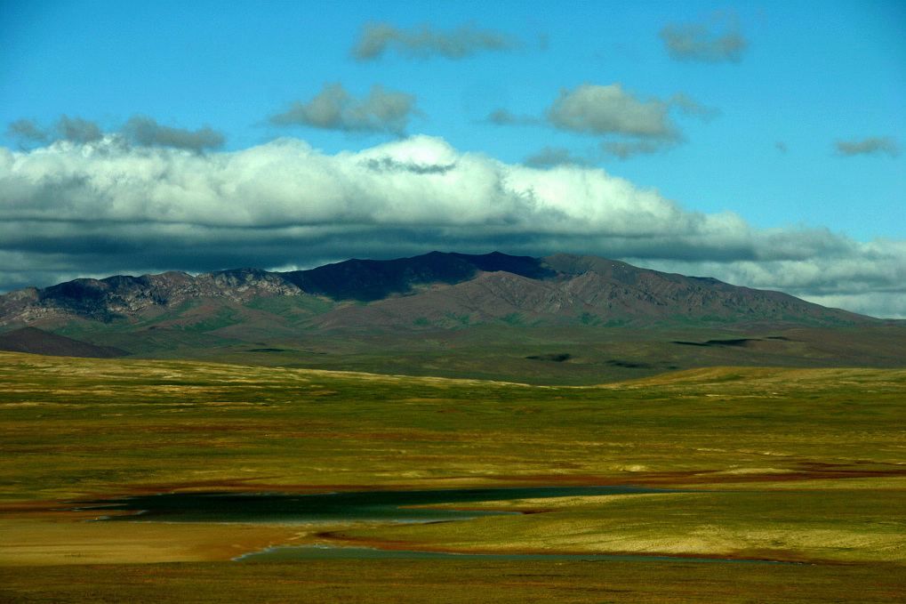
Overview
| Designation | UNESCO World Heritage (natural, 2017) |
| Name | Qinghai Hoh Xil |
| Country | China |
| Nearby cities | Ürümqi, Lanzhou, Xining, Lhasa |
| Nearby sites | Sanjiangyuan National Park 377km, Tanggula Mountains and the Source of the Nu River 384km Search nearby |
| Mountains | Kunlun Mountains |
| Latitude, longitude | 35.38, 92.44 Google Maps |
| Themes | Highland, Wildlife, Grassland, Night sky & aurora |
About
Qinghai Hoh Xil (青海可可西里) was inscribed on the UNESCO World Heritage List in 2017 as a natural site.
Why it was inscribed
Superb natural scenery; an important habitat for biodiversity and threatened species.
Hoh Xil, in western Qinghai in the heart of the Qinghai-Tibet Plateau, lies mostly above 4,500 m with mean annual temperatures below 0°C. It keeps intact high-plateau grassland and lake ecosystems; over a third of its plants and all its hoofed mammals are found only on the plateau, and it covers the whole migration route of the Tibetan antelope between wintering and calving grounds.
Travel tips
Access: The reserve covers about 45,000 sq km at an average altitude of about 4,600 m. It has no tourist facilities, and the core area is not open to general visits. Ordinary visitors see its edge and the transport routes that run along it.
Getting there: The Qinghai-Tibet Highway (G109) and the Qinghai-Tibet Railway run along the eastern boundary of the reserve. From Xining or Golmud, by road or train along this corridor, there is a chance of seeing Tibetan antelope, kiang and other wildlife at a distance.
Along the road: Ranger stations and viewing points beside the highway explain the reserve and its anti-poaching work. Hoh Xil is best known for protecting the Tibetan antelope, and the Zhuonai Lake area is a gathering place for them.
Cities: Golmud is the main city for the area and Xining is the larger starting point; both have an airport and a railway station.
Time: Simply travelling the highway means long hours on the road. Entering the reserve's interior requires permission from the authorities and a specialist guide and is not an ordinary tourist route.
Season: Summer has the best road conditions and wildlife is more active. Winter is bitterly cold and windy, with snow and ice on high sections.
Altitude: The whole area is very high; the entrances of the Fenghuoshan Tunnel, for example, are at about 4,905 m. Acclimatise gradually; people with heart or lung conditions should not go.
Note: Do not chase or feed wildlife, and do not leave the road onto the grassland.
Photo credits: Hoh Xil, Qinghai: 始见 (Archived) (CC BY 2.5 cn, Wikimedia Commons)
Nearby
| World Heritage | Mogao Caves 558km, Yumen Pass 567km, Xuanquanzhi 599km |
| National parks of China | Sanjiangyuan National Park 377km |
| National parks | Tanggula Mountains and the Source of the Nu River 384km |
| National geoparks | Golmud Kunlunshan National Geopark 247km |
| Nature reserves | Hoh Xil National Nature Reserve 113km |