 Park of China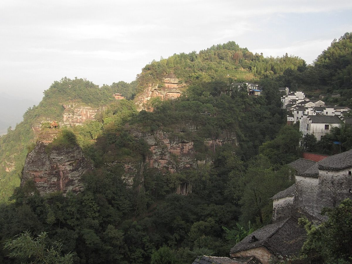
Overview
| Designation | National Park of China (third batch) |
| Province | Anhui |
| Location | Anhui |
| Mountains | Mountain Ranges of China |
| Latitude, longitude | 29.8, 118.0 Google Maps |
| Nearby cities | Hangzhou, Nanchang, Hefei |
| Highlights | Danxia landform, dinosaur fossils, Taoism, Buddhism |
| Area | 110 km² |
| Nearby sites | Ancient Villages in Southern Anhui 10km, Huangshan (Yellow Mountains) 38km, Mount Jiuhua 74km, Jingdezhen Handicraft Porcelain Industry Sites 95km, Mount Sanqing 101km Search nearby |
| Themes | Famous Mountain, Mountain, Taoism, Red Rock, Buddha, Cave, Inscription, Cable Car, Fossils & geological sites, Hiking & climbing |
About
Mount Qiyun lies in Xiuning, Anhui, between the Shuaishui and Hengjiang, the two main tributaries of the Xin’an, a Danxia peak-cluster landform. With Huangshan and Mount Jiuhua it is one of the three famous mountains of southern Anhui.
Qiyun Shan was anciently called Baiyue; in the Ming Jiajing era it was renamed for a rock that "pierces the sky and reaches the clouds". Taoism here dates from the Tang (758–760) and flourished in the Ming with the cult of Zhenwu, earning it the name Little Wudang; it is counted with Wudang, Qingcheng and Longhu among the four great Taoist mountains.
It is in the third batch of national parks of China (national scenic areas) named by the State Council in 1994.
Travel tips
Getting there: Mount Qiyun is in Xiuning county, Huangshan city, about 30 km from Tunxi. Huangshan North has high-speed trains; take a vehicle from Tunxi or Xiuning to the site. Tunxi airport is close by.
Main sights: Taisu Palace, Yuxu Palace, the Zhenxian Cave, Yuehua Street, Zixiao Cliff and Incense Burner Peak, spread over cliffs and in caves.
Route: paths climb from the gate through Taisu Palace to Yuehua Street; some sights are in cliff caves reached by steps, and a cable car can be used for part of the way.
Danxia landscape: Qiyun is a cluster of red peaks, and the red cliffs with Taoist temples look best in morning mist.
Time: half a day to a day; when combined with Huangshan it is usually a day before or after.
Season: spring and autumn are most comfortable, with good colour in autumn; summer is rainy and winter is cold.
Where to stay: Tunxi and Xiuning town are easiest; Wan'an old town is also possible.
Caution: steps are steep and slippery after rain; the cliff caves are dim, so watch your footing.
Photo credits: Mount Qiyun: Julienfuchs (CC BY-SA 3.0, Wikimedia Commons)
Nearby
| World Heritage | Ancient Villages in Southern Anhui: Xidi and Hongcun 10km, Huangshan (Yellow Mountains) 38km, Jingdezhen Handicraft Porcelain Industry Sites 95km, Mount Sanqing 101km |
| National parks of China | Wuyishan National Park 240km |
| National parks | Huashan Mystery Caves and the Jian River 38km, Gaoling and Yaoli 51km, Longchuan 71km, Mount Jiuhua 74km |
| AAAAA attractions | Ancient Huizhou Cultural Tourist Area 39km, Wuyuan Jiangwan Scenic Area 50km, Huangling Scenic Area 56km, Kaihua Root Palace Buddhist Culture Tourist Area 85km |
| AAAA attractions | Nanping Scenic Area 14km, Liyang In Alley 30km, Yansi New Fourth Army Headquarters Site Memorial Hall 31km, Guchengyan Scenic Area 32km |
| UNESCO Global Geoparks | Changshan UNESCO Global Geopark 113km |
| Historic cities | Yi County 13km, She County 41km, Jixi County 63km, Jingdezhen 96km |
| Historical sites | Qiyun Mountain Inscriptions 3km, Xiuning Dengfeng Bridge 4km, Xidi Village Ancient Building Complex 10km, Nanping Village Ancient Building Complex 14km |
| National geoparks | Changshan National Geopark 113km, Fushan National Geopark 140km |
| Nature reserves | Wuyuan Forest Birds National Nature Reserve 43km, Gutianshan National Nature Reserve 76km, Qingliangfeng National Nature Reserve 85km, Lin'an Qingliangfeng National Nature Reserve 98km |
| Historic towns | Wan'an Town 20km, Xixinan Town 27km, Xucun Town 36km |
| Historic villages | Xidi Village 10km, Hongcun Village 13km, Nanping Village 14km, Huangcun Village 22km |