 Park of China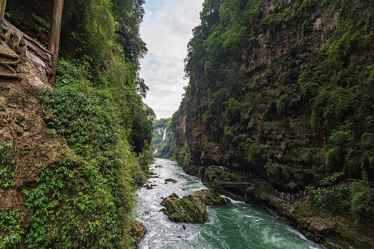
Overview
| Designation | National Park of China (third batch) |
| Province | Guizhou |
| Location | Xingyi, Guizhou, where Guizhou, Yunnan and Guangxi meet, between the Wumeng Mountains of the Yunnan–Guizhou plateau and the hills of Guangxi |
| Latitude, longitude | 25.1, 105.0 Google Maps |
| Highlights | Gorge fissure, travertine waterfalls, karst peak clusters |
| Top sights | Maling River Gorge, the Wanfeng peak forest |
| Area | 450 km² |
| Elevation | 800–1,400 m |
| Nearby cities | Xingyi (Guizhou) 6km, Guiyang 334km, Kunming 321km |
| Nearby sites | Huangguoshu Waterfall 120km, Puzhehei 139km, Dragon Palace Caves 143km, Stone Forest of Lunan 171km, Zhijin Cave 200km Search nearby |
| Themes | Canyon, Waterfall, River, Karst, Peak, Cliff, Reservoir, Cable Car, Rafting & boat trips, Hiking & climbing |
About
The Maling River scenic area lies between the Wumeng Mountains and the hills of Guangxi about 6 km east of Xingyi, capital of south-west Guizhou, 450 km² in all. Called the place of “a hundred waterfalls, a hundred curtains, a hundred springs”, it is known for its gorge fissure, travertine waterfalls and karst peak clusters, with cave systems and travertine “murals”, in three parts: the Maling Gorge, Wanfeng Lake and the Wanfeng peak forest. The Maling is a tributary of the Nanpan River rising at Baiguoling in the Wumeng Mountains; it is called the Qingshui in its upper course and the Maling in its middle course after the villages of Mabie and Maling.
It is in the third batch of national parks of China (national scenic areas) named by the State Council in 1994.
Main sights
Tianxing Gallery: the most concentrated stretch of waterfalls in Maling River Canyon, with large calcified rock walls and falls, and the canyon's main attraction.
Canyon walkways: paths along the canyon rim and floor give views of the falls and cliffs from different heights, with steps between levels.
Chelang hot springs: at the Bouyei village of Chelang upstream, with a spring on each side of the river known as the 'son' and 'daughter' springs.
Five-Colour Gallery: a 20 km stretch of canyon between Longyin and Maling, with colourful rock walls, passed on rafting trips.
Wanfeng Forest: south of Xingyi, divided into east and west parts; the west part is the more open, with fields, streams and villages between the peaks.
Nahui village: in the west part of the forest, known for terraced fields laid out in an eight-trigram pattern, a common viewpoint over the peaks.
Jinfeng Ridge: a viewpoint in the Wanfeng Forest overlooking the peaks and fields.
Wanfeng Lake: south of the Wanfeng Forest, a reservoir on the Nanpan River bordering Guizhou, Yunnan and Guangxi, with many karst peaks rising from the water.
Liu Family Manor: in Xingyi city, a late Qing and early Republican mansion and an important historic building of the region.
Geology and landscape
The area is on the slope between the Yunnan-Guizhou Plateau and the hills of Guangxi, dropping from about 1,400 m on the plateau to a few hundred metres in the Nanpan valley. Rivers cutting down this gradient made the Maling canyon.
The rock is mainly Triassic limestone and dolomite, easily dissolved by slightly acidic water, producing caves, sinkholes, and the peak clusters and forests of a karst landscape. Peaks joined at the base are called peak clusters, and those standing apart are peak forests.
Triassic strata around Xingyi hold abundant marine reptile fossils, including ichthyosaurs and sauropterygians, from a sea fauna more than 200 million years old, and this is one of Guizhou's well-known fossil areas.
The calcified waterfalls form as water rich in calcium carbonate runs down the cliff and deposits a crust on the rock; the deposits are pale, and algae and moss tint them green or brown.
Maling River Gorge
The gorge, 74 km², lies on the river 6 km east of Xingyi. It is a narrow fissure torn open by crustal movement 70 million years ago and deepened by the river: 74.8 km long, 200 to 400 m wide and deep on average, 50 m at its narrowest and 500 m at its deepest, with a fall of nearly 1,000 m. Because the many tributaries cut down more slowly than the main river, over a hundred waterfalls more than 100 m high plunge into the gorge. A 7 km walkway, the main section 1.7 km, allows visitors to explore on foot.
The Tianxing Gallery is the finest stretch, famous for its waterfall groups and hanging rock faces. The 9.7 km from the old Maling bridge to Tianxing bridge has 56 waterfalls, 36 flowing all year; the 1.7 km gallery alone has 13, among them the Ten Thousand Roaring Horses, Pearl, Veil, Intermittent Five-Tier, Moon-Scooping, Heart-Washing, Road Curtain and Flying Hall falls, 120 to 200 m high and 20 to 110 m wide. The water is heavy with calcium carbonate, which coats the cliffs in vast travertine waterfalls; the cliffs of the gallery alone carry over 300,000 m² of them.
The winding gorge with its many rapids is a fine place for rafting. It can be run all year, best from June to October when all 13 main waterfalls flow. Boarding rubber rafts at the Maling ferry, you pass the Chelang hot springs, the Five-Colour Gallery, the Tianxing Gallery and the Zhaojia ferry.
The Chelang hot springs lie upstream at the old Bouyei village of Chelang, one spring on each bank, the “Sons’ Spring” on the left and the “Daughters’ Spring” on the right, 38 to 40 °C, where Bouyei men and women have bathed facing each other across the river since ancient times. The 20 km from Longyin to Maling town is the “Five-Colour Gallery”.
The Wanfeng peak forest
The Wanfeng (“Ten Thousand Peaks”) area south of Xingyi is a karst peak cluster: lone peaks ringed by clear streams, broad fields and scattered farmhouses. Xu Xiake singled it out as a true forest of peaks, standing apart like bamboo shoots.
Wanfeng Lake
Wanfeng Lake is a reservoir behind the Tianshengqiao dam, 160 km² of water with over a thousand peaks rising from it, another Thousand Island Lake. A 50 km rafting route from the gorge to the lake links the three areas into one tourist line.
Travel tips
Getting there: the park is in Xingyi, Qianxinan Prefecture. Xingyi Wanfenglin Airport has flights from Guiyang, Kunming, Guangzhou and elsewhere; a high-speed rail line opened in November 2025, with trains from Guiyang to Xingyi South in about two hours; expressways from Guiyang and Kunming take about four hours by car.
Three areas: Maling River Canyon east of town, the Wanfeng Forest south of it, and Wanfeng Lake further south; they are tens of kilometres apart and each needs a vehicle.
Maling River Canyon: boardwalks along the canyon top and bottom; the Tianxing gallery has the densest waterfalls. There are steps and slopes.
Rafting: the canyon can be rafted; water is highest and waterfalls most numerous from June to October.
Wanfeng Forest: karst peak clusters, seen from buses, walkways and cycle routes through the fields; morning and evening light is best.
Wanfeng Lake: a reservoir best seen from a boat; it takes a long trip, so allow time.
Time: half a day for the canyon, half a day to a day for the Forest; about two days for everything.
Season: summer and autumn bring high water and full waterfalls; rapeseed flowers in spring make the peaks look best; winter is mild with less water.
Where to stay: Xingyi city is the easiest base; there are also guesthouses near the Wanfeng Forest.
Events
In October 1999 a cable car fell at the Malinghe scenic area, killing 14 people and seriously injuring 20; those responsible were sentenced.
Map
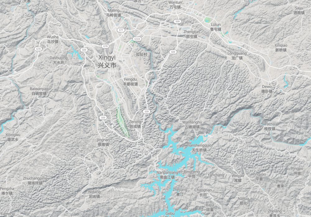
Photo credits: Maling River Gorge: Jayden Chao (CC BY-SA 4.0, Wikimedia Commons)
Nearby
| World Heritage | Stone Forest of Lunan 171km, Chengjiang Fossil Site 209km, Libo and the Zhangjiang River 276km |
| National parks | Getu River Caves, Ziyun 97km, Huangguoshu Waterfall 120km, Puzhehei 139km, Alu Caves 139km |
| AAAAA attractions | Wanfeng Forest Scenic Area 12km |
| AAAA attractions | Wanfeng Lake 21km |
| UNESCO Global Geoparks | Xingyi UNESCO Global Geopark 10km, Stone Forest UNESCO Global Geopark 162km |
| Historical sites | Liu Family Manor of Xingyi 10km, Lutun Archway Group 16km, Xingyi Wantun Tombs 17km, Longguang Guanyin Cave Site 21km |
| National geoparks | Xingyi National Geopark 10km, Luoping Biota National Geopark 60km, Luxi Alu National Geopark 139km |
| Nature reserves | Jinzhongshan Hume's Pheasant National Nature Reserve 54km, Yachang Orchids National Nature Reserve 140km |