 Park of China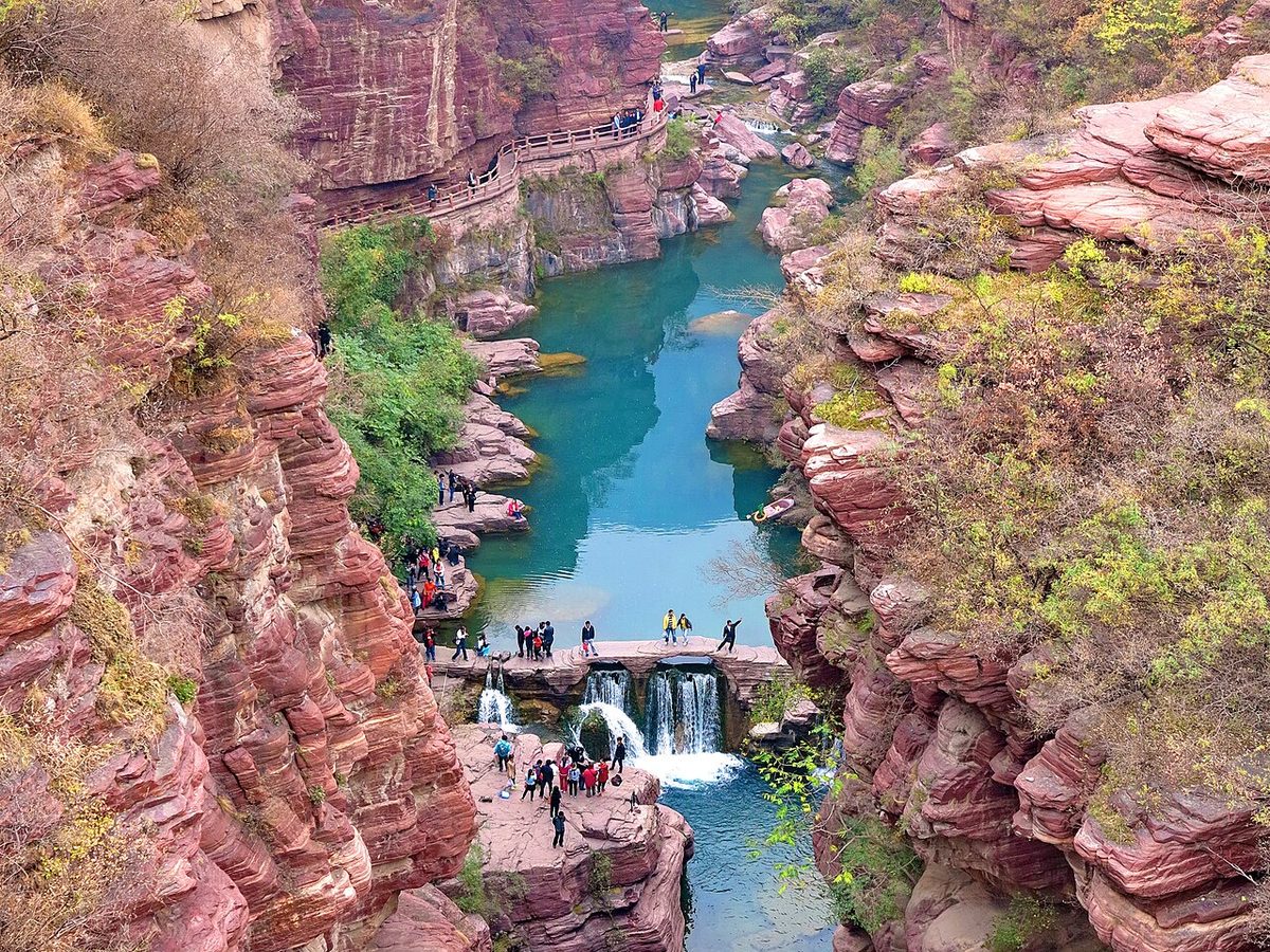
Overview
| Designation | Part of the third-batch National Park of China “Mount Wangwu–Mount Yuntai” UNESCO Global Geopark National geopark (second batch) AAAAA tourist attraction |
| Province | Henan |
| Location | Henan |
| Mountains | Taihang Mountains |
| Latitude, longitude | 35.4, 113.4 Google Maps |
| Highlights | Deep gorges, sheer cliffs |
| Top sights | Red Stone Gorge |
| Area | 110 km² |
| Nearby cities | Xiuwu (Henan), Jiaozuo, Zhengzhou |
| Nearby sites | Wangmang Ridge 33km, Yin Xu, Anyang 106km, Shaolin Temple 110km, Mount Song 111km, Longmen Grottoes, Luoyang 127km Search nearby |
| Themes | Glen, Valley, Cliff, Mountain, Small Waterfall, Stream, Reservoir, Taoism, Waterfall |
About
Mount Yuntai is in Xiuwu County, Jiaozuo, in northern Henan, at the southern end of the Taihang Mountains.
Mount Yuntai’s main peak, Zhuyu, is 1,300 m; its sights are the deep Red Stone Gorge and a waterfall with a drop of 310 m.
It is part of the Mount Wangwu–Mount Yuntai scenic area, in the third batch of national parks of China (national scenic areas) named by the State Council in 1994.
Main sights
Red Rock Gorge: a narrow gorge between purple-red quartz sandstone cliffs, with a path winding up and down past falls and deep pools.
Pool Waterfall Gorge (Xiaozhaigou): a valley with a chain of waterfalls and pools.
Spring Waterfall Gorge (Laotangou): it ends at the Yuntai Waterfall, which drops over 300 m; in the dry season it is a thin stream.
Zhuyu Peak: the main summit, with a Zhenwu temple on top; tradition links it with Wang Wei’s poem about wearing dogwood (zhuyu) on the Double Ninth festival.
Travel tips
Access: for Yuntai, go to Jiaozuo first, then take a park shuttle or taxi, well under an hour. Zhengzhou is the nearest large city and airport, with fast trains and buses to Jiaozuo. Jiyuan lies west of Jiaozuo.
Yuntai Mountain: the Red Rock Gorge is a stream cutting between red cliffs; the Spring Waterfall Gorge, Pool Waterfall Gorge and Zhuyu Peak are the other main parts. Park buses link them.
Booking: Yuntai is busy in season and tickets are mostly bought online under your real name; book ahead on holidays.
Season: spring and autumn are comfortable, and the Red Rock Gorge is colourful in autumn; summer is cool in the hills but paths are slippery after rain; in winter waterfalls may freeze or run low.
Map

Photo credits: Red Stone Gorge, Mount Yuntai: Nyx Ning (CC BY-SA 3.0, Wikimedia Commons)
Nearby
| World Heritage | The Old City of Luoyang in Han and Wei Dynasties 104km, Yin Xu, Anyang 106km, Shaolin Temple 110km, Mount Song 111km |
| National parks | Qingtian River 37km, Mount Wangwu–Mount Yuntai Scenic Area 51km, Zhengzhou Yellow River 55km, Mount Shennong 59km |
| Detailed guides | Wangmang Ridge 33km, Mount Wangwu 103km |
| AAAAA attractions | Baoquan Tourist Area 10km, Baligou Scenic Area 24km, Baquan Gorge 61km, Huangcheng Xiangfu Ecological and Cultural Tourist Area 71km |
| AAAA attractions | Baoquan Resort 11km, Yuanrong Temple 21km, Guanshan 23km, South-to-North Water Diversion Tianhe Park 26km |
| UNESCO Global Geoparks | Wangwushan-Daimeishan UNESCO Global Geopark 103km |
| Historic cities | Zhengzhou 80km |
| Cities | Zhengzhou 74km, Luoyang 119km |
| Historical sites | Pagoda of Baijiayan Temple 4km, Chanling of Emperor Xian of Han 10km, Tashuihe Site 13km, Baiyun Temple 16km |
| National geoparks | Guanshan National Geopark 23km, Hongqiqu-Linlüshan National Geopark 109km, Songshan Stratigraphic Structure National Geopark 111km |
| Nature reserves | Danjiang Wetland National Nature Reserve 71km, Yangcheng Manghe Macaque National Nature Reserve 86km, Lishan National Nature Reserve 136km |
| Historic towns | Gaodu Town 41km |
| Historic villages | Yidoushui Village 5km, Suzhuang Village 49km |