 Park of China
Overview
| Designation | UNESCO World Heritage (natural, 1979) US National Park |
| Location | Arizona, on the Colorado River |
| Latitude, longitude | 36.1, -112.0 Google Maps |
| Highlights | Giant canyon, waterfalls |
| Top sights | Hermit Road, the canyon floor |
| Wildlife | Mountain lions |
| Area | 1,217,000 acres |
| Length | 277 miles |
| Depth | 6,000 ft |
| Nearby cities | Las Vegas |
| Nearby sites | Zion National Park 160km, Bryce Canyon National Park 165km, Petrified Forest National Park 234km, Capitol Reef National Park 255km Search nearby |
| Themes | Canyon, River, Desert, Stamp, Hiking & climbing, Viewpoints & photography, Rafting & boat trips |
About
Grand Canyon National Park is in Arizona, in the southwestern United States. The Colorado River carved the canyon over six million years. It is 277 miles long, up to 6,000 feet deep and up to 18 miles wide.
The oldest rocks in the canyon formed 2 billion years ago. The national park was created in 1919.
You can enter the Grand Canyon from the South Rim or the North Rim.
Most visitors base themselves at Grand Canyon Village on the South Rim.
On day one, explore Hermit Road, west of Grand Canyon Village.
On day two, drive Desert View Drive, east of Grand Canyon Village.
With more time, consider going down to the Colorado River at the bottom of the canyon. The park offers guided mule rides, but you must book ahead.
Visitor map

Main sights
Mather Point: the viewpoint beside the South Rim visitor center, where most visitors have their first look into the canyon, with views east, west and across to the North Rim.
Yavapai Point: east of the village, with the Yavapai Geology Museum beside the rim, where large windows and displays explain the canyon's rock layers.
Grand Canyon Village: the centre of the South Rim, with El Tovar Hotel (1905), Hopi House and the head of the Bright Angel Trail.
Hermit Road: runs about 11 km west from the village past Hopi Point, Mohave Point and Pima Point to Hermits Rest, with popular sunset viewpoints along the way.
Desert View Drive: runs about 40 km east of the village past Lipan Point and Navajo Point to Desert View Watchtower, a stone tower built in 1932, from which a stretch of the Colorado River can be seen.
Phantom Ranch: on the canyon floor beside Bright Angel Creek near the Colorado River, reachable only on foot, by mule or by river, and the main place to stay overnight in the canyon.
North Rim: about 300 m higher than the South Rim, with viewpoints at Cape Royal, Point Imperial, the highest point on either rim, and Bright Angel Point.
Havasu Falls: in the Havasupai reservation in a side canyon to the west, outside the national park, known for its blue-green water.
Geology and landscape
The canyon walls read like a geology textbook. The rim is Kaibab Limestone, about 270 million years old, and below it come Coconino Sandstone, Redwall Limestone, Tapeats Sandstone and others, down to the much older metamorphic rocks of the Inner Gorge, such as the Vishnu Schist.
Gaps in the record between layers are called unconformities. The best known is the Great Unconformity, where Cambrian sandstone lies directly on the old schist, with over a billion years of rock missing between them.
The Colorado Plateau, on which the canyon lies, has been slowly and fairly evenly uplifted, so the river kept cutting down faster than the walls could weather away, leaving a deep, narrow gorge. The height difference between rim and river gives the canyon several climate and vegetation zones.
The different hardness of the layers gives the walls a stepped profile: limestone and sandstone form cliffs, and shale forms gentler slopes. The South Rim is about 2,100 m above sea level, the North Rim about 2,500 m, and the river on the canyon floor only about 700 m.
Travel tips
Getting there: Grand Canyon Village on the South Rim is about 1.5 hours' drive from Flagstaff, 3.5 hours from Phoenix and 4.5 hours from Las Vegas. Tusayan, next to the park, has a small airport and hotels; a train runs from Williams to the South Rim.
Entry: entry does not currently require a reservation, but parking is scarce in peak season.
Shuttle: free shuttle buses on several routes link the visitor centre, viewpoints and the village; Hermit Road to the west is closed to private cars and open to shuttles only from March to November.
Main viewpoints: Mather Point, the Yavapai Geology Museum, the overlooks along Hermit Road, and the Desert View Watchtower on Desert View Drive to the east.
Into the canyon: the Bright Angel Trail and the South Kaibab Trail are the usual routes down; a round trip to the river in a single day is extremely tiring, and most walkers turn back partway. Overnight stays at the bottom need a booking or permit.
North Rim: the North Rim is about 4.5 hours' drive from the South Rim, higher and quieter, and is open only from roughly mid-May to mid-October.
Time: allow at least two days at the South Rim, and more for hiking down or visiting the North Rim.
Season: spring and autumn are most comfortable; the inner canyon is extremely hot in summer while the rim stays cooler; in winter the South Rim has snow and icy trails.
Where to stay: inside the park there are Mather Campground and several lodges, including El Tovar on the rim, booked up to a year ahead for peak season; Tusayan and Williams are alternatives.
Caution: many edges have no railing, so keep your distance; in summer do not hike down at midday, and allow about twice as long for the climb out as for the descent.
Stamps


Grand Canyon Skywalk
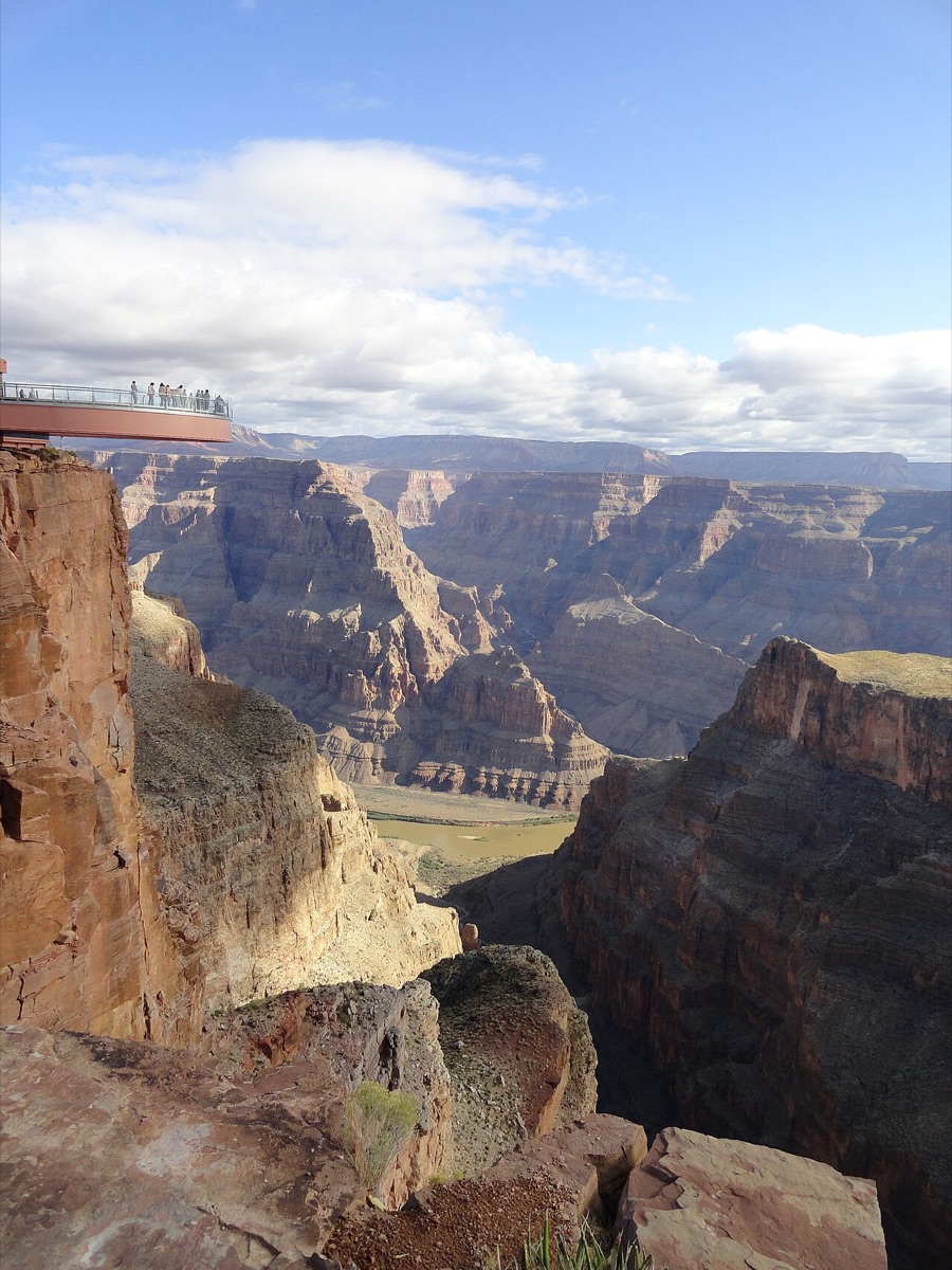
The Grand Canyon Skywalk is in Grand Canyon West, on the Hualapai Indian Reservation in Arizona. It opened on March 20, 2007. Built on a cliff at Grand Canyon West, 4,000 feet above the canyon floor, it is a 10-foot-wide, U-shaped glass viewing platform. From a distance it looks like a giant horseshoe, and it juts 70 feet out from the cliff edge. The project cost about $41 million.
Grand Canyon West is not part of Grand Canyon National Park.
The tribe puts up no railings or fences there, so visitors can walk right up to the cliff edge to take in the view.
More photos

Map
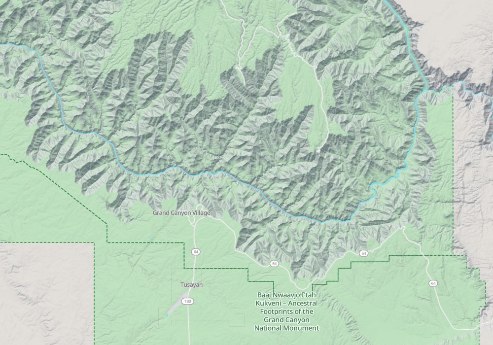
Photo credits: Grand Canyon National Park: Dietmar Rabich (CC BY-SA 4.0, Wikimedia Commons)