 Park of China
Overview
| Designation | UNESCO World Heritage (natural, 2010) National Park of China (second batch) |
| Province | Guangdong |
| Location | Renhua County, Guangdong, where Hunan, Jiangxi and Guangdong meet |
| Latitude, longitude | 25.0, 113.7 Google Maps |
| Nearby sites | Dongjiang Lake 113km, Sanbaishan (Three Hundred Mountains) 168km, Jinggangshan 172km, Jiuyi Mountain and Mausoleum of Emperor Shun 184km, Mount Luofu 193km Search nearby |
| Highlights | Danxia landform |
| Top sights | Monk’s Hat Peak, Teapot Peak, Xianglong Lake |
| Area | 280 km² |
| Nearby cities | Shaoguan |
| Themes | Red Rock, Mountain, Lake, River, Stamp, Rafting & boat trips, Hiking & climbing |
About
Mount Danxia lies in Renhua County, Guangdong, 45 km north-east of Shaoguan where Hunan, Jiangxi and Guangdong meet, about 280 km² in the Danxia, Shaoshi, Dashi and Aizhai areas.
The name means “red glow”, from its cliffs “red as cinnabar, bright as rosy clouds”. It is a national park and a national nature reserve, and on 13 February 2004 UNESCO named it among the first Global Geoparks.
Biechuan Temple: on the middle tier of Changlao Peak, founded in the early Qing by the Chan master Dangui; it is Danxia Shan's main temple. Dangui named the twelve Danxia views, including Jinshui Tansheng and Danti Tiesuo.
It is in the second batch of national parks of China (national scenic areas) named by the State Council in 1988.
Travel tips
Getting there: Shaoguan station is on the Beijing–Guangzhou high-speed line. From Shaoguan a bus or taxi to Danxiashan takes about an hour.
Changlao Peak: the main area, reached on foot or by cable car; from the top you see Monk's Cap Peak and the Jin River. Xianglong Lake lies below the peak, with boats on the lake.
Yangyuan Stone: in a separate area, reached by park shuttle bus from the entrance, with a short path.
Jin River: boats run along the river under the red cliffs.
Bazhai: the highest peak of Danxiashan; the path is steep and long. The Shaoshi Shan area is also quiet, for those with more time.
Time: one day for the main sights; two days is more relaxed.
Season: autumn and winter have more clear days for walking; summer is hot and rainy, and spring often misty.
Where to stay: villages near the entrance have many guesthouses, convenient for early or late walks; Shaoguan and Renhua town are alternatives.
Main sights
Monk’s Hat Peak, in the north-west, is named for its shape; sheer on all sides, it is the emblem of Danxia, and legend says a local king’s treasure is hidden on top.
Xianglong Lake lies below Changlao Peak in a valley once called the Dragon Pit; the Tiger Head Rock by the river to the west, the White Tiger Gully to the east and the nearby Dragon King Flat, Rock, Spring and Nine-Dragon Peak and Temple are all tied to legends of the Taoist master Zhang. A reservoir built in the early 1980s became the lake.
Teapot Peak is remarkably lifelike, with a lid and a spout but no handle; the Danxia landform is especially clear here.
The Jin River rises at Xianrenling in Chongyi County, Jiangxi, enters northern Guangdong, winds round Mount Danxia and joins the Zhen River. It is said the riverbed holds many brocade-coloured stones, hence the name “Brocade River”. It flows slowly round the red cliffs, and the sound of its rising and falling, “the Jin River rapids”, was one of the famous sights of old Danxia.
The Yangyuan and Yinyuan rocks are named for their resemblance to the male and female organs.
The Danxia landform
Mount Danxia is formed of red sandstone and conglomerate with sheer red cliffs; the geological term “Danxia landform” is named after it. It belongs to the red-bed landforms, the red rock series deposited between the Jurassic and the Tertiary. Danxia landforms occur mainly in China, the western United States, central Europe and Australia; China has the most, and Mount Danxia is the largest, most typical, most complete, most varied and most beautiful.
Stamps
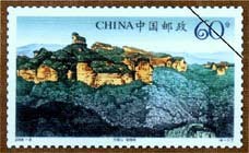
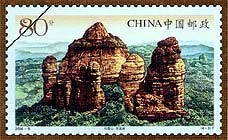
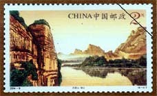
On 1 May 2004 China Post issued “Mount Danxia”, four stamps: Monk’s Hat Peak, Xianglong Lake, Teapot Peak and the Jin River.

Map
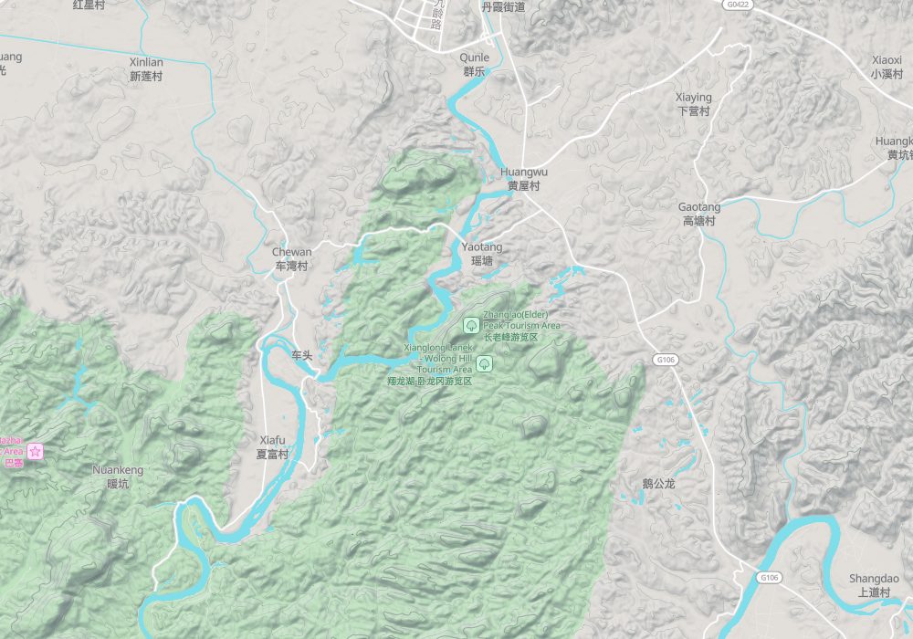
Photo credits: Mount Danxia: xiquinhosilva (CC BY 2.0, Wikimedia Commons)
Nearby
| National parks | Dongjiang Lake 113km, Suxianling and Wanhuayan 113km, Xiaowudang Mountain 115km, Mausoleum of the Yan Emperor 160km |
| AAAAA attractions | Lianzhou Underground River Tourist Area 143km, Wanlu Lake Scenic Area 169km |
| AAAA attractions | Ligong Tourism Area 29km, Jing-Lü-Lun Cultural Tourism Town Scenic Area 36km, Caoxi Hot Spring Holiday Resort 40km, Ancient Buddha Cave Scenic Area 42km |
| Historical sites | Yunlong Temple Pagoda 17km, Shuangfeng Stockade 19km |
| National geoparks | Chenzhou Feitianshan National Geopark 107km, Yangshan National Geopark 126km |
| Nature reserves | Chebaling National Nature Reserve 53km, Shimentai National Nature Reserve 78km, Mangshan National Nature Reserve 90km, Jiulianshan National Nature Reserve 93km |
| Historic villages | Shitang Village 19km |