 Park of China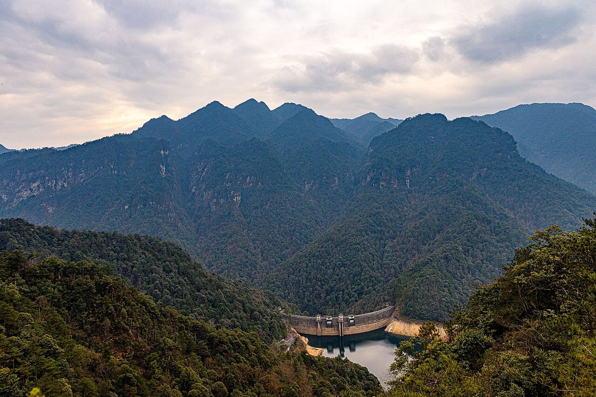
Overview
| Designation | National Park of China (first batch) AAAAA tourist attraction |
| Province | Jiangxi |
| Location | South-west Jiangxi, middle of the Luoxiao range |
| Mountains | Luoxiao Mountains |
| Latitude, longitude | 26.5, 114.1 Google Maps |
| Highlights | Cradle of the Chinese revolution |
| Top sights | Ciping, Wuzhi Peak, the Longtan waterfalls |
| Wildlife | Yew |
| Area | 214 km² |
| Elevation | 1,841 m |
| Highest point | 1,598 m |
| Nearby cities | Ji'an, Nanchang, Changsha |
| Nearby sites | Mount Wugong 104km, Dongjiang Lake 109km, Fairy Lake (Xiannü Lake) 149km, Mount Heng (Southern Sacred Mountain) 168km, Mount Danxia 172km Search nearby |
| Themes | Famous Mountain, Mountain, Forest, Waterfall, Culture, Banknote, Stamp, Peak, Revolutionary sites, Hiking & climbing |
About
Jinggangshan, the “cradle of the revolution”, lies in south-west Jiangxi on the border with Hunan in the middle of the Luoxiao range, a scenic area of 214 km². The main sights are Ciping, Wuzhi (Five Fingers) Peak and the Longtan waterfalls; the highest point, Jiangxi’ao, is 1,841 m.
In October 1927 Mao Zedong led the troops of the Autumn Harvest Uprising to Jinggangshan and set up the first rural revolutionary base. In April 1928 Zhu De and Chen Yi arrived with their forces; the two armies met at Longshi in Ninggang and formed the Fourth Army of the Workers’ and Peasants’ Revolutionary Army (later the Fourth Red Army).
Five mountain passes guard the way into the central area of Ciping: Huangyangjie, Bamianshan, Shuangmashi, Tongmuling and Zhushachong, known as the Five Sentry Posts.
Huangyangjie, about 1,343 m high, is where the Red Fourth Army repelled Nationalist troops from Hunan and Jiangxi on 30 August 1928, the Battle of Huangyangjie.
The scenic area is divided into eight zones: Ciping, Huangyangjie, Longtan, the Main Peak, Tongmuling, Xiangzhou, Bijiashan and Xiankou.
It is in the first batch of national parks of China (national scenic areas) named by the State Council in 1982.
Travel tips
Getting there: fly to Jinggangshan Airport, or take a train to Ji'an, then a bus up the mountain to Ciping. Ciping is the center of the scenic area; shuttle buses link the sights.
Ciping: former residences of Mao Zedong and others, the Jinggangshan Revolution Museum and the Martyrs' Cemetery, all within walking distance.
Huangyangjie: a former Red Army sentry post and battlefield, northwest of Ciping, with a wide view over the Luoxiao Mountains.
Wuzhi Peak (Five-Finger Peak): the main peak, shown on the back of the 100-yuan note of the fourth series; usually seen from a viewing platform, not climbed.
Longtan Waterfalls: northwest of Ciping, a gorge with several falls; the path has many steps, and a cable car can save part of the walk.
Other sights: Bijia Mountain, the Octagonal Tower at Maoping, and the villages of Dajing and Xiaojing, as time allows.
Time: two days are enough for the main sights.
Season: summer on the mountain is cooler than in the lowlands; azaleas flower in April and May; there may be ice and snow in winter. It is busy in the summer holidays and when large tour groups visit.
Where to stay: most visitors stay in Ciping town.
Banknotes and stamps
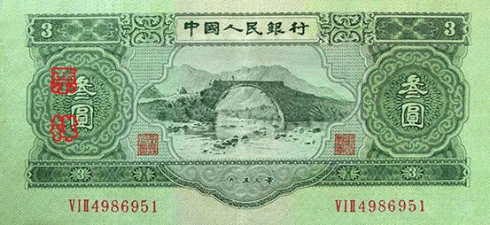
The 3-yuan note of the second series of renminbi (1955) shows Jinggangshan.
The back of the 100-yuan note of the fourth series (1988) shows Wuzhi Peak.

In 1965 China Post issued S70 “Cradle of the Revolution: Jinggangshan”, eight stamps: Ciping, Sanwan village, the Octagonal Building at Maoping, Longshi, Dajing village, Longyuankou, Huangyangjie and the main peak.

Map
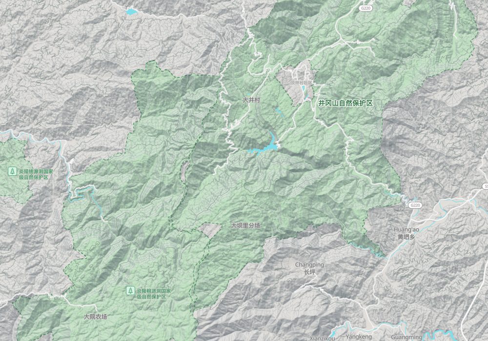
Photo credits: Five Finger Peak, Jinggangshan: N509FZ (CC BY-SA 4.0, Wikimedia Commons)
Nearby
| World Heritage | Mount Danxia 172km, Jinhu Scenic Area 290km |
| National parks of China | Wuyishan National Park 398km |
| National parks | Mausoleum of the Yan Emperor 32km, Mount Wugong 104km, Dongjiang Lake 109km, Suxianling and Wanhuayan 132km |
| AAAAA attractions | Mingyueshan Tourist Area 121km |
| Historical sites | Jinggangshan Revolutionary Sites 7km |
| National geoparks | Jiubujiang National Geopark 98km, Chenzhou Feitianshan National Geopark 127km |
| Nature reserves | Yanling Taoyuandong National Nature Reserve 4km, Nanfengmian National Nature Reserve 24km, Bamianshan National Nature Reserve 88km, Qiyunshan National Nature Reserve 114km |