 Park of China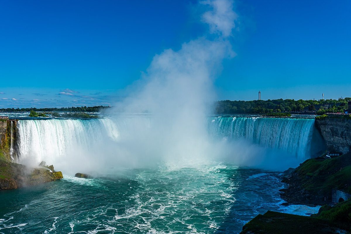
Overview
| Location | On the US–Canada border |
| Latitude, longitude | 43.1, -79.1 Google Maps |
| Nearby sites | Cuyahoga Valley National Park, Moravian Church Settlements, Independence Hall, Shenandoah National Park |
| Highlights | Great waterfalls |
| Nearby cities | Buffalo, Toronto (Canada) |
| Themes | Waterfall, Lake, River, Stamp, Rafting & boat trips, Night views |
About
Niagara Falls is on the border between the United States and Canada.
Main sights
Horseshoe Falls (also called the Canadian Falls): the largest, curved section. It lies mostly on the Canadian side, and the international boundary passes through it. The drop is about 50 m and most of the river goes over here, often sending spray high into the air.
American Falls: on the New York side, straighter and about 300 m wide, with a pile of fallen rock at its base.
Bridal Veil Falls: the smallest section, separated from the American Falls by Luna Island.
Goat Island: on the American side, between Horseshoe Falls and American Falls. It is part of Niagara Falls State Park, established in 1885 and among the earliest state parks in the United States. Terrapin Point at its western end gives a close view of the lip of Horseshoe Falls.
Queen Victoria Park: on the Canadian bank, with paths along the river facing both falls. It is a standard place for a panoramic view of the falls.
Maid of the Mist and other boat tours: boats go to the foot of Horseshoe Falls for a close look at the spray and falling water. There are landings on both the American and Canadian sides.
Cave of the Winds: on the American side, where wooden walkways lead to the base of Bridal Veil Falls.
Journey Behind the Falls: on the Canadian side, with elevators and tunnels leading to openings behind Horseshoe Falls.
Rainbow Bridge: spans the gorge below the falls and links the two cities, one in each country. It is a border crossing and also a viewpoint.
Niagara Whirlpool: about 4 km downstream, where the river turns sharply and forms a large eddy. Walking paths run along it, and the Whirlpool Aero Car crosses above.
Geology and landscape
The Niagara River links Lake Erie and Lake Ontario over about 56 km, and the two lakes differ in level by about 99 m. Most of that drop is concentrated near the falls.
The falls lie on the Niagara Escarpment. A harder dolostone caps softer shale; the water undercuts the shale, the cap breaks off when unsupported, and the falls retreat upstream.
The falls formed when the ice sheet withdrew about 12,000 years ago and the river began to drop over the escarpment. Since then they have moved about 11 km upstream, leaving a deep gorge behind them.
The retreat used to average about a metre a year. It is much slower now, since part of the upstream flow is diverted for power and the rock is reinforced in places. The two countries share the river under a treaty that keeps a larger flow over the falls by day in the tourist season and allows more water to be used for power at night.
Travel tips
Getting there: the nearest airport on the American side is Buffalo Niagara International Airport, about half an hour from the falls. For the Canadian side, Toronto is about an hour and a half by road, with trains and coaches as well.
Crossing the border: the two sides are connected by Rainbow Bridge, which can be crossed on foot or by vehicle. Carry a passport and hold any visa required by the country you enter.
Viewing: the Canadian side faces the falls and shows all three sections at once. On the American side you can walk to the edge of the water and look at the flow from Goat Island.
Boats and walkways: the boat tours, Cave of the Winds and Journey Behind the Falls all go close to the spray; you will get wet, and ponchos are normally provided.
Night: the falls are lit in colour in the evening, and there are fireworks at some times in summer.
Time: half a day is enough for the falls and a boat trip. Visiting both sides, or adding the Whirlpool and the gorge paths, takes a day or more.
Season: the boats mainly run from late spring to autumn. In winter the spray freezes on rocks and trees, giving a different scene, and some attractions are closed.
Nearby: about 20 km north along the river, on Lake Ontario, is the town of Niagara-on-the-Lake, with a wine region on the Canadian side.
Map
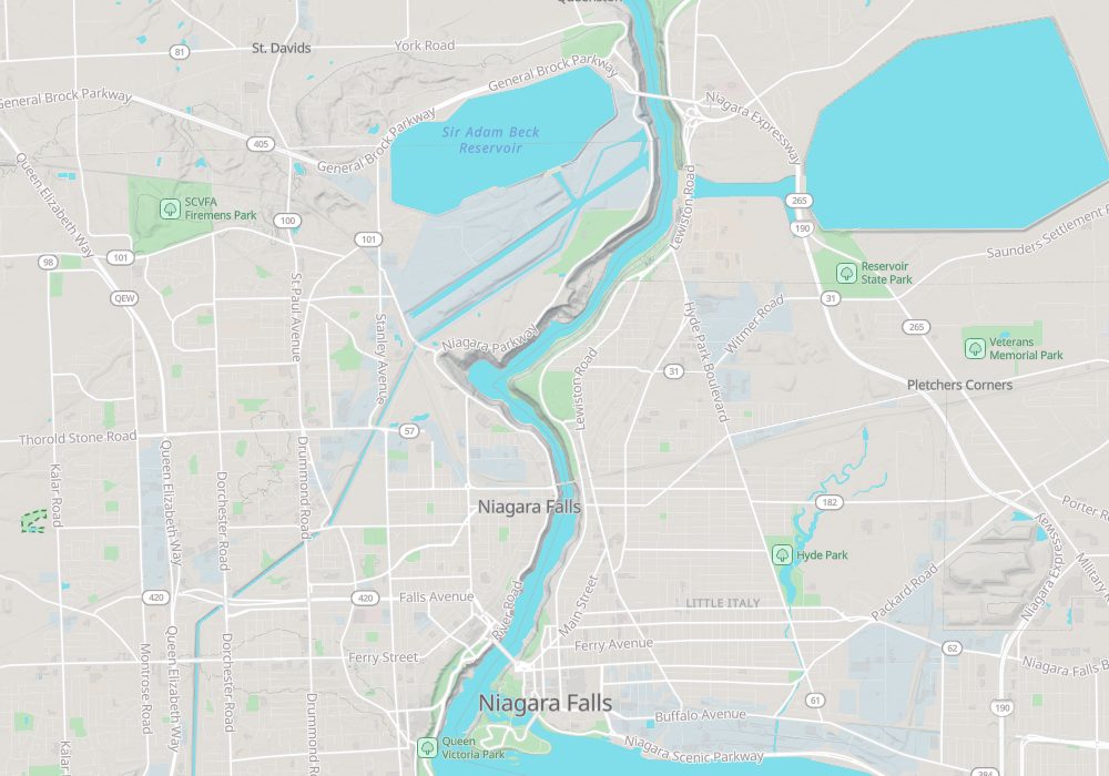
Photo credits: Niagara Falls: Maksimsokolov (CC BY-SA 4.0, Wikimedia Commons)