 Park of China
Overview
| Designation | National Park of China (first batch) |
| Province | Yunnan |
| Location | Southern tip of Yunnan on the Myanmar border |
| Latitude, longitude | 21.6, 100.7 Google Maps |
| Nearby sites | Cultural Landscape of Old Tea Forests of the Jingmai Mountain in Pu’er 97km, Cultural Landscape of Honghe Hani Rice Terraces 274km, Jianshui Scenic Area 316km Search nearby |
| Highlights | Tropical rainforest |
| Wildlife | Asian elephant, vulture, Indochinese tiger, leopard, gaur, goral, slow loris |
| Area | 1,202 km² |
| Nearby cities | Jinghong |
| Themes | Forest, Plant, Wildlife, Stamp, River, Buddha, Tropical rainforest, Ethnic cultures, Tea, Hot springs |
About
The Xishuangbanna scenic area lies in the Xishuangbanna Dai Autonomous Prefecture at the southern tip of Yunnan, south of the Tropic of Cancer where mainland Asia merges into the Indochinese peninsula. It has three parts, in Jinghong City and Menghai and Mengla counties, 1,202 km² in all. The name is Dai: “sipsong” means twelve and “panna” a thousand mu of land.
It is rich in wildlife: more than 5,000 species of higher plants, over 10,000 edible, more than 50 wild fruits and over 40 fast-growing valuable timber trees; 429 bird and 67 mammal species, among them the Asian elephant, vulture, Indochinese tiger, leopard, gaur, goral and slow loris.
The climate is tropical rainforest, sunny and wet, with a dry season from November to April and a wet season from May to October; the annual mean is 21 °C, there is never frost or snow, and there are 108 to 146 foggy days a year. Jinghong has recorded extremes of 41.1 °C and 2.7 °C; it is pleasant to visit all year.
The Parashorea chinensis (wangtianshu) of the dipterocarp family usually grows 50–60 m tall and can exceed 80 m, far above the rainforest canopy. It was found in Mengla in the 1970s and has been under first-class state protection since 1999.
Manfeilong Pagodas: on the hill behind Manfeilong village in Menglong, Jinghong, built in 1204. Nine white stupas, a main one about 16 m high ringed by eight smaller ones, form the most important Buddhist monument in Xishuangbanna.
Jingzhen Octagonal Pavilion: in Jingzhen Temple, Menghai County, built in 1701, a brick-and-timber sermon hall of Dai Buddhism with many layered roofs; a nationally protected monument since 1988.
Ganlanba: the riverside plain of Menghan town south-east of Jinghong on the Lancang (Mekong), dense with Dai villages; five of them, including Manchunman and Manting, form the Dai Ethnic Garden.
Wild Elephant Valley: in Mengyang Town north of Jinghong, west of National Highway 213, a valley often visited by Asian elephants.
It is in the first batch of national parks of China (national scenic areas) named by the State Council in 1982.
Travel tips
Getting there: Xishuangbanna Gasa Airport is near Jinghong, with direct flights from Kunming of about an hour. Since the China–Laos Railway opened, trains from Kunming to Xishuangbanna station take a little over three hours. From Jinghong, buses or hired cars go to the sights.
Tropical Botanical Garden: the Xishuangbanna Tropical Botanical Garden of the Chinese Academy of Sciences is at Menglun in Mengla County, about an hour's drive from Jinghong. It is large; allow most of a day.
Wild Elephant Valley: north of Jinghong, with paths and raised walkways through the rainforest. Wild Asian elephants come and go and may not be seen.
Other sights: Menghai is a Pu'er tea area with tea hills and Dai and Hani villages; in Jinghong, Manting Park and the night market by the Lancang (Mekong) River suit an evening.
Time: three or four days for Jinghong and the main sights nearby.
Season: the dry season, November to April, is sunny and the best time to go; May to October is hot and rainy. The Dai New Year Water-Splashing Festival is in mid-April; it and the Spring Festival are very busy.
Where to stay: most visitors stay in Jinghong; for the botanical garden, consider a night in Menglun.
Caution: the sun is strong and there are many mosquitoes; bring sun protection and insect repellent.
Stamps
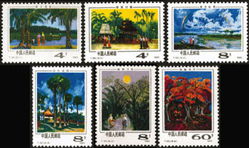
On 20 January 1981 China Post issued T55 “Scenery of Xishuangbanna”, six stamps: dawn on blue water, a Dai village, a rainbow over the Lancang, the palm-leaf temple, moonlight in Banna and flame trees in bloom.
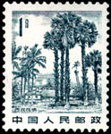
The first stamp of the 1981 definitive set R21 “Scenery of the Motherland” shows Xishuangbanna.
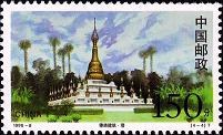
In 1998 China Post issued 1998-8 “Dai Architecture”, four stamps: a house, a well, a pavilion and a pagoda.


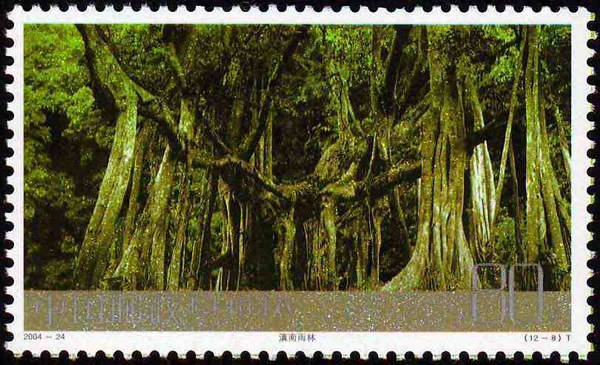
The eighth stamp of 2004-24 “Frontier Scenery of China”, a set of twelve issued in 2004, shows the rainforest of southern Yunnan.
Map
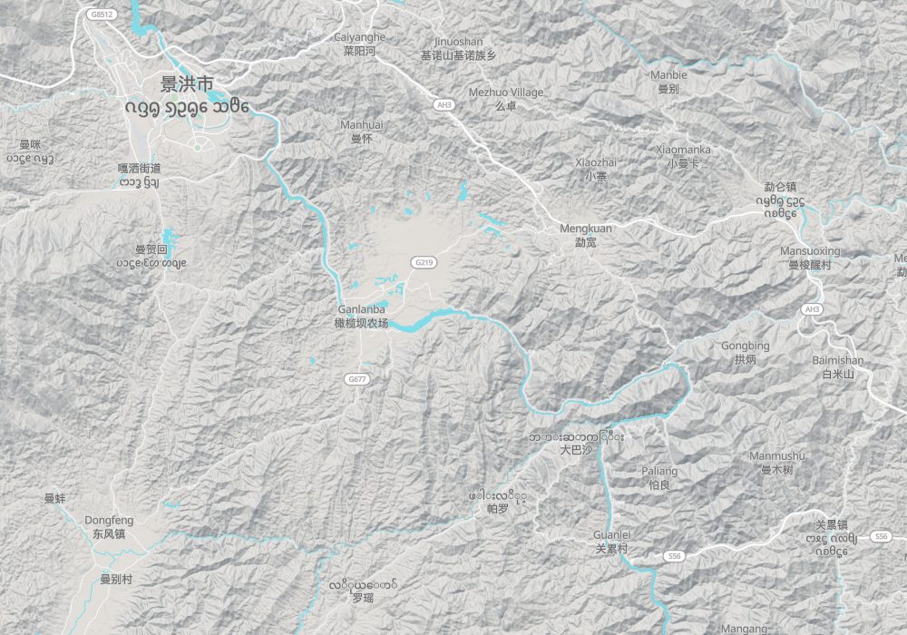
Photo credits: Xishuangbanna: Colin W (CC BY-SA 3.0, Wikimedia Commons)