 Park of China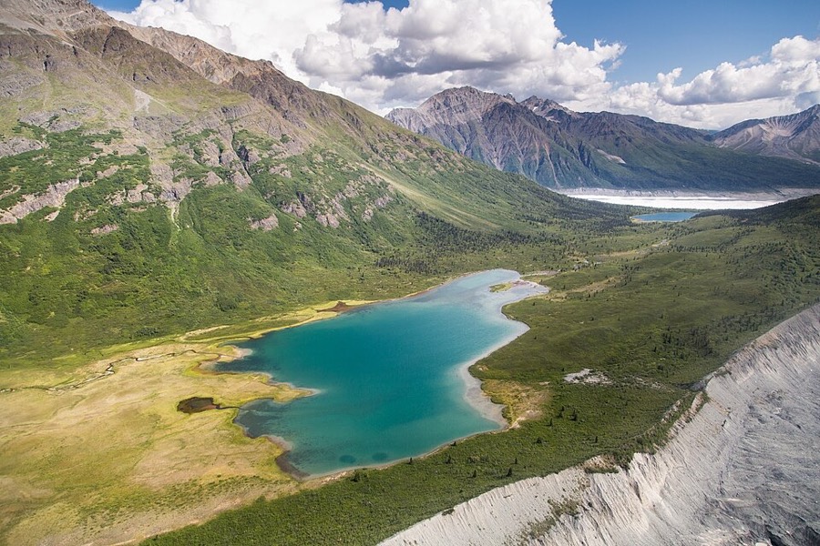
Overview
| Designation | UNESCO World Heritage (natural, 1979) US National Park |
| Location | Alaska, USA, about 200 miles east of Anchorage |
| Latitude, longitude | 61.3, -143.5 Google Maps |
| Highlights | Largest national park in the US; snow-capped peaks, glaciers |
| Wildlife | Mountain goats |
| Area | 13,188,000 acres |
| Highest point | 18,008 ft |
| Nearby cities | Valdez AK, Anchorage |
| Nearby sites | Kenai Fjords National Park 397km, Denali National Park and Preserve 433km, Glacier Bay National Park 462km, Lake Clark National Park and Preserve 542km Search nearby |
| Themes | Mountain, Snow Mountain, Glacier, Building, Peak, Volcano, Hiking & climbing, Scenic drives, Night sky & aurora |
About
Wrangell–St. Elias National Park is in eastern Alaska, on the border with Canada, about 200 miles east of Anchorage. It is the largest national park in the United States.
The park lies where the Wrangell Mountains, the St. Elias Mountains and the Chugach Mountains meet. It has four peaks over 16,000 ft and more than 150 glaciers, and is called the mountain kingdom of North America.
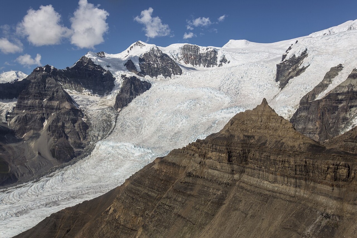
Wrangell–St. Elias National Park and Glacier Bay National Park in the US, together with Kluane and Tatshenshini-Alsek in Canada, form a single World Natural Heritage site.
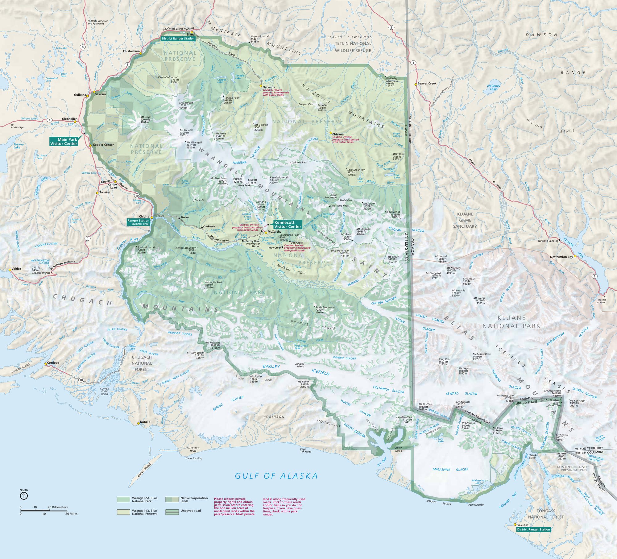
Only two gravel roads enter the park, both on the east side. In the south, the road from Chitina to McCarthy is 61 miles long. In the north, the road from Slana to Nabesna is 42 miles long.
The McCarthy Road ends at a narrow bridge that cars cannot cross.
Kennicott is 5 miles away on the mountainside. Park, cross the bridge, then walk or take a shuttle.
At Kennicott you can see the abandoned copper mine, snowy peaks and glaciers.
Visitor map
Travel tips
What it is: This is the largest national park in the United States; most of it has no roads and is reached by two gravel roads and by small aircraft.
Getting there: From Anchorage, take the Glenn and Richardson highways to the visitor center at Copper Center, about 5 hours. For McCarthy continue south-east to Chitina and take the 60-mile (97 km) McCarthy Road, usually four to five hours in all.
McCarthy Road: The surface is gravel on an old railway bed, and punctures are common; many car rental companies do not allow it.
Kennecott: Kennecott, about 8 km beyond McCarthy, is a former copper-mining camp with a well-preserved red mill; reach it from the footbridge at McCarthy by shuttle or on foot.
Glaciers: The Root Glacier can be walked to, and guided glacier walks are offered; the moraine hills of the Kennicott Glacier lie beside the village.
Flying: Small aircraft fly over the glaciers and mountains from Chitina, McCarthy and Anchorage; the weather decides whether flights go.
Time and season: Roads and lodging are open in summer, from June to September; allow at least two or three days; most services close in winter.
Where to stay: McCarthy and Kennecott have a few small lodges and guesthouses; backcountry camping is also possible in the park.
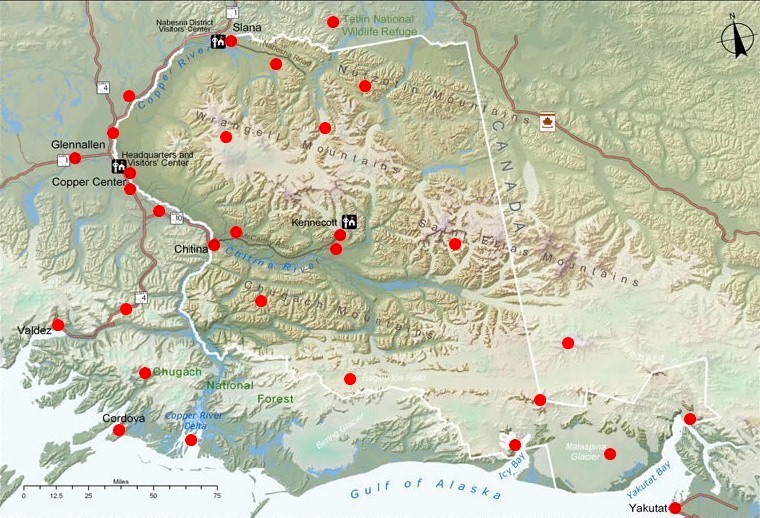
Maps

Lodging
There is lodging at Kennecott inside the park, but it is hard to reach. Cars cannot cross the bridge at McCarthy, so you must cross on foot and then take a shuttle.
Outside the park you can stay in Copper Center.
Getting there
Roads in the park are poor. If you drive yourself, prepare well.
A shuttle bus runs to and from McCarthy daily, but it is expensive.
You can fly from Chitina to McCarthy in a small plane.
Flightseeing tours in small planes leave from McCarthy.
Tips
Check road conditions before you drive in. Some sections may need a four-wheel-drive vehicle and a spare tire.
The speed limit on the gravel roads is 30 mph.
Some rental car companies do not allow their cars to be driven into Wrangell–St. Elias National Park.
Valdez
Valdez is a seaside town ringed by snowy mountains and is called Little Switzerland. It lies about 100 miles south of Chitina and is the northernmost ice-free port in the United States.
Every summer, tens of thousands of salmon spawn here.
The Richardson Highway (Route 4) from Wrangell–St. Elias to Valdez passes snowy peaks, glaciers and waterfalls.
Ferries run between Valdez and Whittier.

Map
