 Park of China
Overview
| Province | Tibet |
| Location | Border of Tibet and Nepal, Himalaya; Tingri |
| Mountains | Himalaya |
| Latitude, longitude | 28.1, 86.8 Google Maps |
| Highlights | The highest mountain in the world; plateau glaciers |
| Top sights | Rongbuk Monastery, Everest base camp |
| Wildlife | Snow leopard, black leopard, leopard, Assam macaque, Tibetan antelope |
| Elevation | 5,200 m |
| Highest point | 8,848.86 m |
| Nearby cities | Tingri, Shigatse |
| Nearby sites | Tashilhunpo Monastery 240km, Yamdrok Lake 384km Search nearby |
| Themes | Mountain, Snow Mountain, Famous Mountain, Peak, Glacier, Highland, Buddha, Stamp, Banknote, Mystery, Hiking & climbing |
About
Qomolangma (Everest), the highest mountain in the world at 8,848.86 m, stands on the border of Tibet and Nepal.
On 29 May 1953 Edmund Hillary and Tenzing Norgay made the first ascent; on 25 May 1960 a Chinese team made the first ascent from the north face.
Main sights
Rongbuk Monastery: a Nyingma monastery at about 5,000 m, at the head of the Rongbuk valley and on the way to base camp; it faces the north face of the mountain.
Everest Base Camp: the visitor camp lies in the valley south of the monastery at about 5,200 m, with tents and simple buildings spread across the valley floor and a direct view of the north face.
Rongbuk Glacier: a large glacier descending from the north face and running north along the Rongbuk valley for about 20 km, known for its ice pinnacles.
East Rongbuk Glacier: a second glacier running alongside, descending from the east side of the mountain, and the starting area for climbing expeditions on the north route.
North Col: the saddle between Everest and its neighbouring peak, at about 7,000 m, a key camp on the north route and not visited by ordinary travellers.
Jiawula Pass: a high pass on the road from Shigatse toward the mountain, from which Everest, Lhotse, Makalu, Cho Oyu and Shishapangma can be seen on a clear day.
Tingri: the last county town before the mountain, at about 4,300 m, used as a base for supplies and acclimatisation.
Geology and landscape
Everest belongs to the Himalaya, which was raised by the collision of the Indian and Eurasian plates and is still rising slowly.
Rock near the summit is Ordovician limestone from the early Palaeozoic, containing marine fossils; it was laid down on a sea floor and later lifted to the highest point on Earth.
The north side of the mountain is a gentler slope, while the south and east sides are much steeper. Glaciers on the north face flow down to the Rongbuk valley, forming ice pinnacles, moraines and meltwater lakes.
Within the nature reserve the land rises from valleys at about 1,400 m to over 8,000 m, and vegetation and wildlife change sharply with height, from shrubs and meadow below to bare rock, ice and scattered cushion plants above.
Travel tips
Getting there: travel by road from Lhasa or Shigatse to Tingri, then south into the reserve and on to Rongbuk Monastery and the base camp; Tingri can also be reached from the Gyirong direction. The road into the reserve climbs in many switchbacks.
Entering: there is a checkpoint at the reserve entrance, and visitors usually change to park vehicles inside. A permit is required and is normally arranged by a travel agency.
Base camp: the visitor camp is in the valley near Rongbuk Monastery at about 5,200 m, with tents and simple meals; conditions are basic and nights are cold.
Viewing: early morning and evening usually give the best views, with the summit changing colour at sunset; on cloudy days the summit may stay hidden all day.
Altitude: Tingri and the base camp are both above 4,300 m. Spend several days acclimatising in Lhasa or Shigatse first, take it easy on arrival, drink water, and descend at once if you have a severe headache or trouble breathing.
Season: the road is open from about April to October, with clearer weather in May and in September and October; winter is severely cold and snow can close the road.
Clothing: ultraviolet radiation is strong and the day-night temperature range is large; bring sun protection and windproof, warm clothing.
Supplies: Tingri is the last place to stock up before the mountain, and there are few shops or fuel stations on the way.
Travel information
Getting there: from Shigatse to Tingri, or from Nepal via the Gyirong border to Tingri, then to base camp; roads are poor and need a good four-wheel drive.
Qomolangma Nature Reserve
The reserve was founded in 1988, raised to national status in April 1994 and joined the world network of biosphere reserves in 2004. A wetland project worth over 14 million yuan planned to fence off over 5,900 hectares and restore 4,400 hectares of wetland, with ecological, weather, hydrological and bird monitoring stations. Preliminary counts give over 2,300 higher plants and over 270 animals, 33 under national protection, including the snow leopard, black leopard, leopard and Assam macaque.
Stamps and banknotes
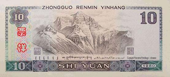
The back of the 10-yuan note of the fourth series of renminbi (1988) shows Everest.
The 13th stamp of the 1981 definitive set R21 “Scenery of the Motherland” shows Everest.

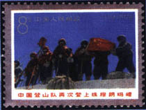
The third stamp of the 1965 set S70 “Mountaineering in China” shows the ascent of Everest.

In 1975 a set of three stamps marked the Chinese team’s second ascent.


Map
Photo credits: Everest from the Rongbuk valley: Luca Galuzzi (CC BY-SA 2.5, Wikimedia Commons)
Nearby
| World Heritage | Sagarmatha National Park 19km, Kathmandu Valley 143km, Khangchendzonga National Park 159km, Chitwan National Park 252km |
| National parks | Namtso and the Nyainqêntanglha Mountains 468km, Yarlung River 479km |
| Detailed guides | Shishapangma 113km |
| AAAAA attractions | Tashilhunpo Monastery 240km |
| Cities | Gyantse 288km |
| Nature reserves | Changtang National Nature Reserve 241km |
| Historic towns | Chentang Town 66km |