Park of China
Overview
| Designation | US National Park |
| Location | Pacific Ocean |
| Latitude, longitude | 14.3, -170.6 Google Maps |
| Nearby cities | Pago Pago |
| Area | 10,500 acres |
| Highest point | 2,142 ft |
| Themes | Ocean, Island, Beach, Forest, Wildlife, Coral reefs, Tropical rainforest |
About
The National Park of American Samoa is in the Pacific Ocean. It became a US national park in 1988.
Visitor map
Travel tips
Getting there: the park lies on three islands of American Samoa: Tutuila, Ofu and Taʻu. International flights land at Pago Pago on Tutuila, with flights from Honolulu.
Entry: American Samoa is a US territory with its own entry rules, so foreign visitors should confirm their visa requirements before travelling.
Inter-island flights: to reach Ofu and Taʻu you transfer to a small plane from Tutuila. Flights are few and are often delayed or cancelled, so leave slack in your plans.
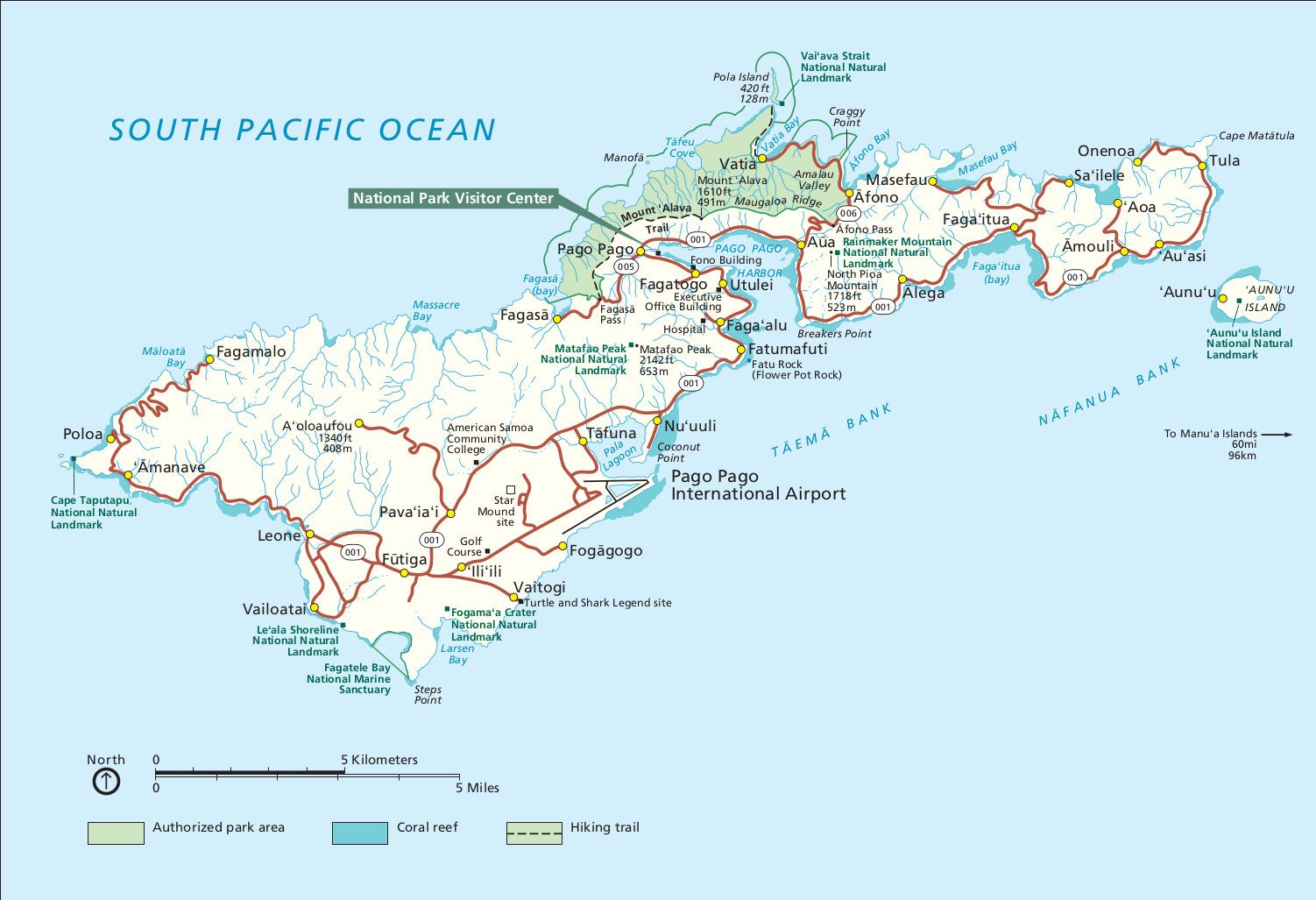
Tutuila: the park here covers coast and mountain land, with a trail up Mount Alava and coastal scenery around Pola Island.
Ofu: the beach on Ofu is good for snorkelling over intact coral reef and is the most popular place in the park; the island has very few facilities.
Culture: most of the park land is owned by villages, and visitors normally need the village's agreement before entering villages or beaches. Respect local custom; activities are limited on Sundays.
Season: it is hot and wet all year; June to September is relatively drier, the wet season runs from November to April, and tropical cyclones can occur.
Where to stay: Pago Pago area on Tutuila has hotels; Ofu and Taʻu have only small guesthouses, which need early booking. The park has no campgrounds.
Map