 Park of China
Overview
| Designation | National Park of China (third batch) |
| Province | Qinghai |
| Location | About 100 km west of Xining, Qinghai |
| Rivers and lakes | Qinghai Lake |
| Latitude, longitude | 36.9, 100.1 Google Maps |
| Nearby sites | Jiayuguan Pass 362km, Badain Jaran Desert - Towers of Sand and Lakes 383km Search nearby |
| Highlights | Plateau salt lake |
| Top sights | Bird Island |
| Elevation | 3,197 m |
| Nearby cities | Xining |
| Themes | Lake, Bird, Island, Highland, Stamp, Grassland, Scenic drives, Flower fields, Viewpoints & photography, Night sky & aurora |
About
Qinghai Lake lies in the north-east of the Tibetan Plateau about 100 km west of Xining, Qinghai, China’s largest salt lake: about 4,658 km² (2025), with about 605 km of shoreline, 20 m deep on average and about 3,197 m above sea level.
Its sights are Haixin Mountain and Bird Island. Haixin (“Heart of the Sea”), also Longju Island, about 1 km², is rocky and famous for its “dragon colts”. Bird Island, about 0.5 km², hosts more than 100,000 migratory birds in spring and summer.
In Tibetan the lake is Tso Ngonpo and in Mongolian Kokonor, both meaning “blue lake”; anciently called the Western Sea, it has been known as Qinghai since the Northern Wei, and the province is named after it.
Riyue Mountain east of the lake divides the farmland of eastern Qinghai from the grazing lands, and the outward-draining rivers from the closed basin.
It is in the third batch of national parks of China (national scenic areas) named by the State Council in 1994.
Travel tips
Getting there: the lake is west of Xining, about 100 km to the east shore and about 150 km to the Erlangjian area. Tourist coaches run from Xining to Erlangjian in summer; a hired car or self-drive is the easiest way to go round. Xining has an airport and railway station.
Circuit: the road around the lake is about 360 km and usually takes two days. Common stops are Erlangjian on the east, Heimahe on the south for sunrise, and Gangcha on the north.
Erlangjian: the easiest area to reach, with a lakeside boardwalk and open views of the lake.
Bird Island: in spring and summer migratory birds breed here; the lake region is an important breeding and stopover wetland for migratory birds, and some areas are closed to visitors for conservation.
Season: June to September is greenest, and rapeseed blooms in July, turning the east and north shores gold; in winter the lake freezes, it is bitterly cold and visitors are few.
Fish migration: in summer naked carp swim up the Shaliu and Buha rivers to spawn, a sight at the lake.
Altitude: the lake is above 3,200 m and Xining about 2,200 m; spend a day or two in Xining first and avoid strenuous effort.
Where to stay: Erlangjian, Heimahe and Gangcha have lodging, which needs booking early in July and August; Xining is another base.
Note: strong sunlight at altitude, so use sun protection; days and nights differ a lot, and summer nights are cold, so bring a heavy jacket.
Stamps
In 2002 China Post issued “Qinghai Lake”, three stamps: the lakeshore, Bird Island and a distant view.
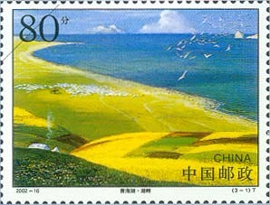
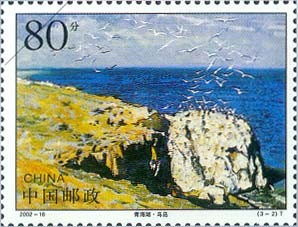
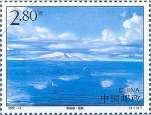
Photo credits: Qinghai Lake: Jonashtand (CC BY-SA 4.0, Wikimedia Commons)