 Park of China
Overview
| Designation | US National Park |
| Location | South Carolina |
| Latitude, longitude | 33.8, -80.8 Google Maps |
| Nearby sites | Great Smoky Mountains National Park 318km, New River Gorge National Park 463km, Shenandoah National Park 599km Search nearby |
| Nearby cities | Columbia |
| Area | about 26,000 acres |
| Themes | Forest, Wetland, Ancient trees |
About
Congaree National Park is in South Carolina. It became a US national park in 2003.
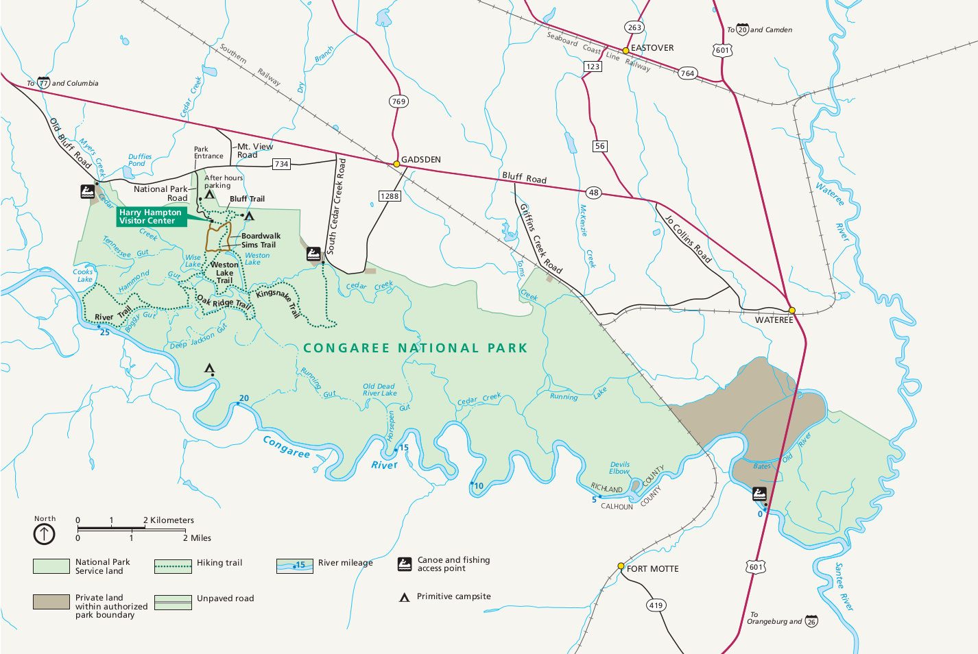
Visitor map
Travel tips
Getting there: the park is in central South Carolina, about 30 minutes' drive from the state capital Columbia, which has an airport. You need a car.
Boardwalk: the elevated Boardwalk Loop, about 2.4 miles from the Harry Hampton Visitor Center, goes through the floodplain forest, is level and is the main way to see the park.
Forest: the park preserves the largest remaining stand of old-growth bottomland hardwood forest in the south-eastern United States, and some bald cypress and loblolly pine trees are over 40 metres tall.
Paddling: Cedar Creek has a marked canoe and kayak trail of about 15 miles, and the park offers guided trips.
Fireflies: in mid to late May, synchronous fireflies flash in the forest after dark; vehicle passes for the viewing event are issued by lottery, applied for in April.
Time: half a day covers the boardwalk and short trails; paddling takes a full day.
Season: spring and autumn are most comfortable; summer is hot and humid with many mosquitoes; winter is mild and quiet.
Where to stay: the park has only campgrounds and backcountry sites; hotels are in Columbia.
Caution: the park is a floodplain, so parts of the boardwalk and trails may be under water after rain; bring insect repellent in summer.
Map
