 Park of China
Overview
| Designation | US National Park |
| Location | Southwestern South Dakota |
| Latitude, longitude | 43.8, -102.2 Google Maps |
| Highlights | Barren eroded hills |
| Wildlife | Bison, bighorn sheep, pronghorn |
| Area | 244,300 acres |
| Nearby cities | Rapid City |
| Nearby sites | Wind Cave National Park 99km Search nearby |
| Themes | Desert, Mountain, Wildlife, Grassland, Fossils & geological sites, Scenic drives |
About
Badlands National Park is in southwestern South Dakota. It became a US national park in 1978.
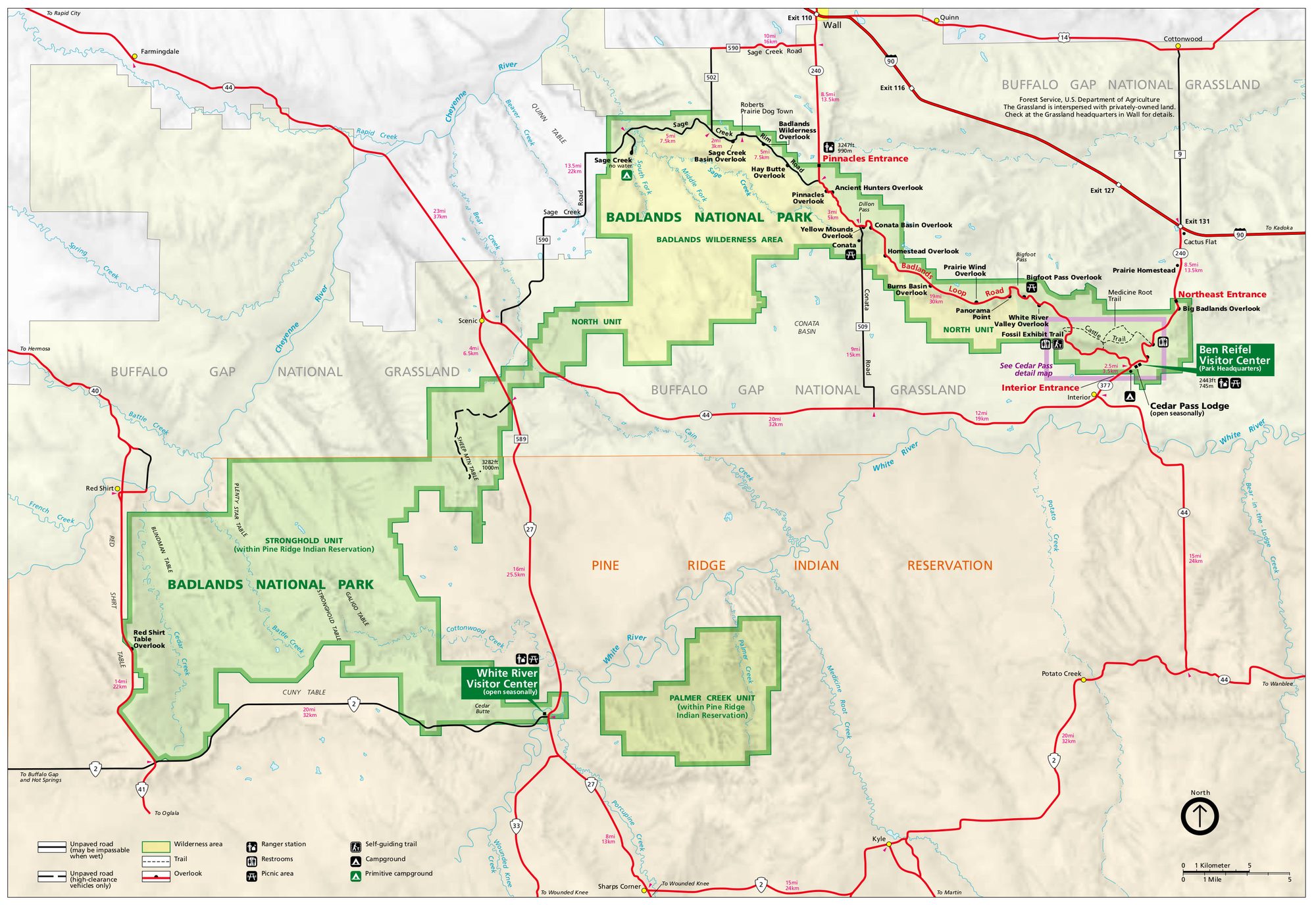
Visitor map
Travel tips
Getting there: the nearest city is Rapid City, which has an airport; from there it is about an hour east on Interstate 90 to the park's northern entrance. There is no public transport, so you need a car.
Main route: the Badlands Loop Road (Highway 240) runs through the northern part of the park with a dozen or so overlooks; a drive with stops takes about half a day.
Short trails: the Door, Window and Notch trails are all short; the Notch Trail ends with a log ladder.
Wildlife: bison, bighorn sheep, pronghorn and prairie dogs often appear near the road. Keep your distance and do not feed them.
South: the Stronghold Unit in the south lies on Lakota land; roads are rougher and visitors are few, so check road and weather conditions first.
Time: one day is enough for the loop; colours in the rock are strongest at sunrise and sunset.
Season: summer is hot with frequent thunderstorms; spring and autumn are milder; winter brings snow and icy roads.
Where to stay: Cedar Pass Lodge and a campground are inside the park, with few rooms; most visitors stay in Wall just north of the park or in Rapid City.
Caution: the rock is soft and slippery after rain, so do not climb the cliffs; carry plenty of water in summer and watch for rattlesnakes.
Map
